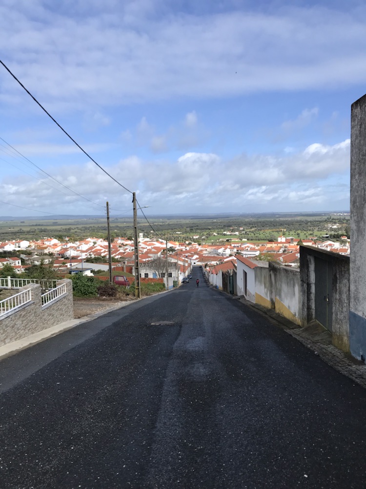
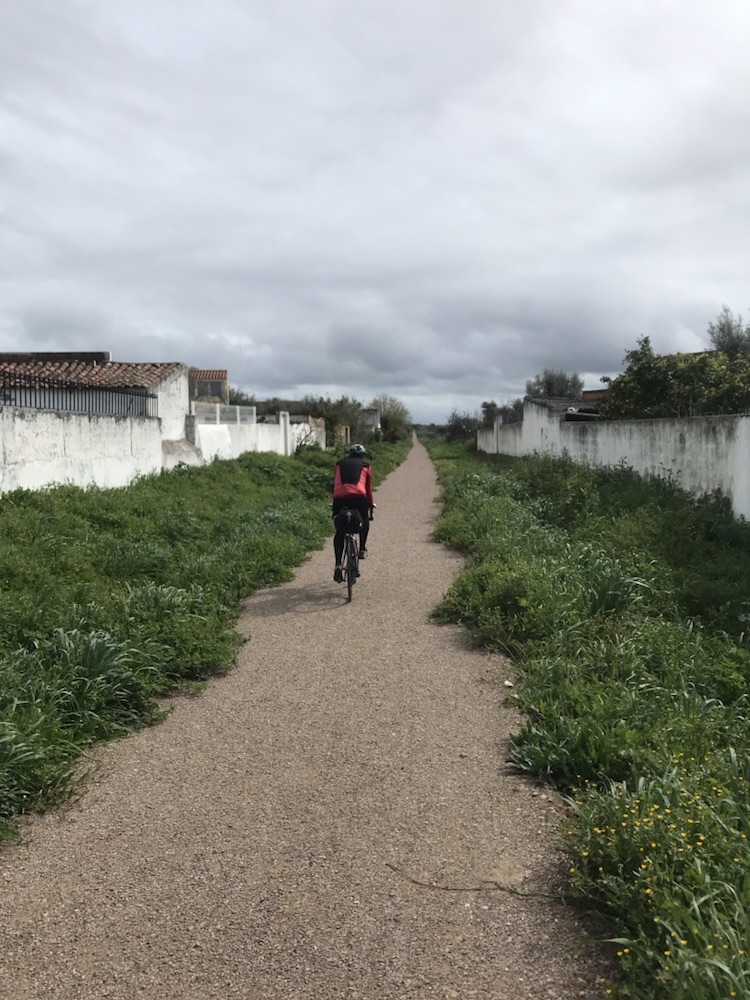
And so the last day. The fastest- 13.2 mph for 39.1 miles with 2,100ft of climb.
Over the final 10 or so miles we averaged 18mph and that was slightly uphill. Have to admit the following wind helped.
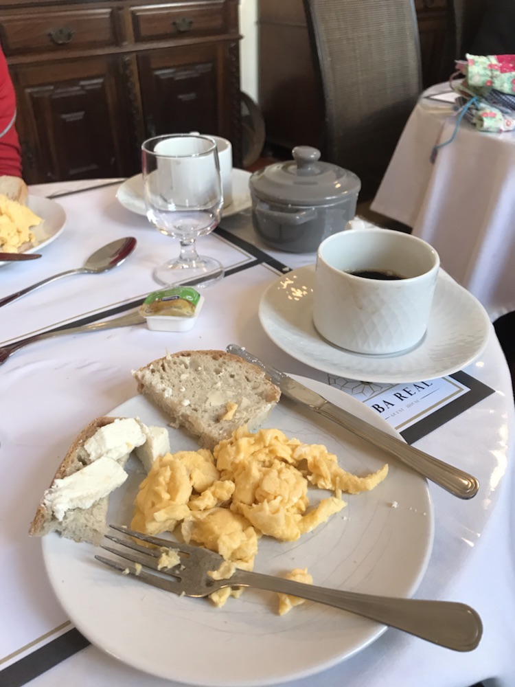
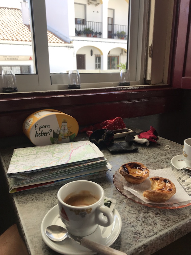
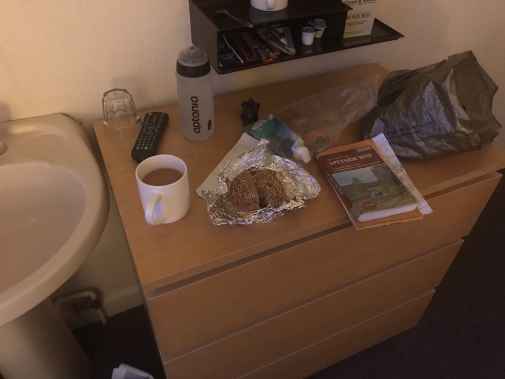
And we were fuelled by the best breakfast of the trip:
Local soft goats cheese, scrambled eggs, bread, fruit, yoghurt and excellent coffee. A well deserved winner.
Left Cuba at the for us incredibly early time of before 09.00. Fortunately the helpful owner of Cuba Real prevented an immediate nav error and sent us in the right direction.
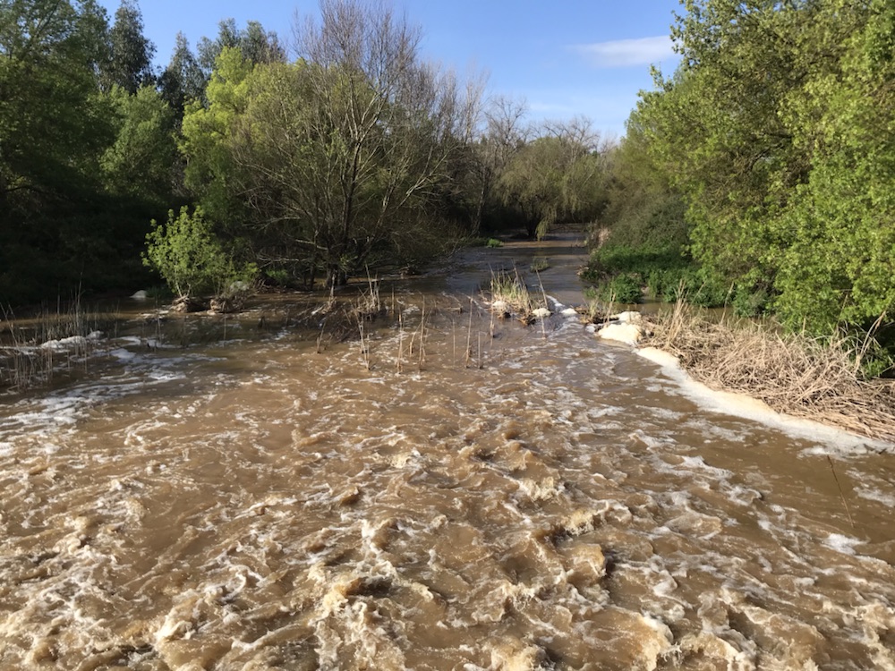
Forecast was for showers so we pushed to get some distance done before another deluge like the night before.
Swollen river. Fields very soggy too.
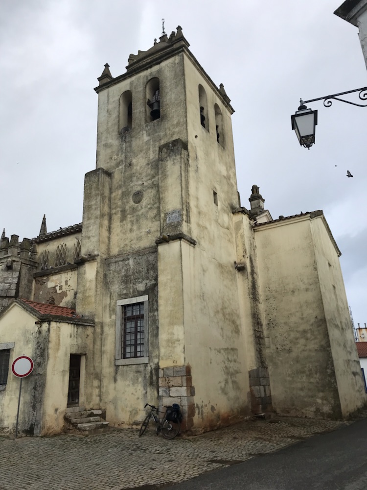
Into Alvito in a light drizzle. Rather damp and miserable (the place not us).
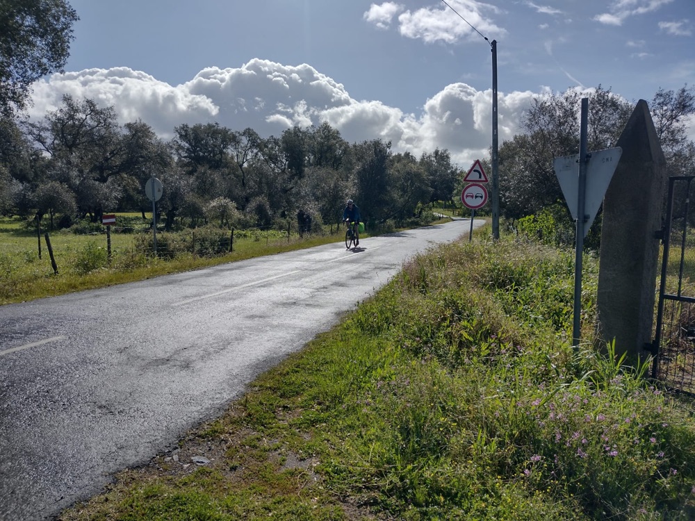
Then the sun came out and enjoyable cycling through the soft countryside:
We decided to not have our usual coffee break until we’d got about half way in Viana do Alentejo. This was at the top of a long slog of a hill but nowhere was open.
Very steep descent as we headed north.
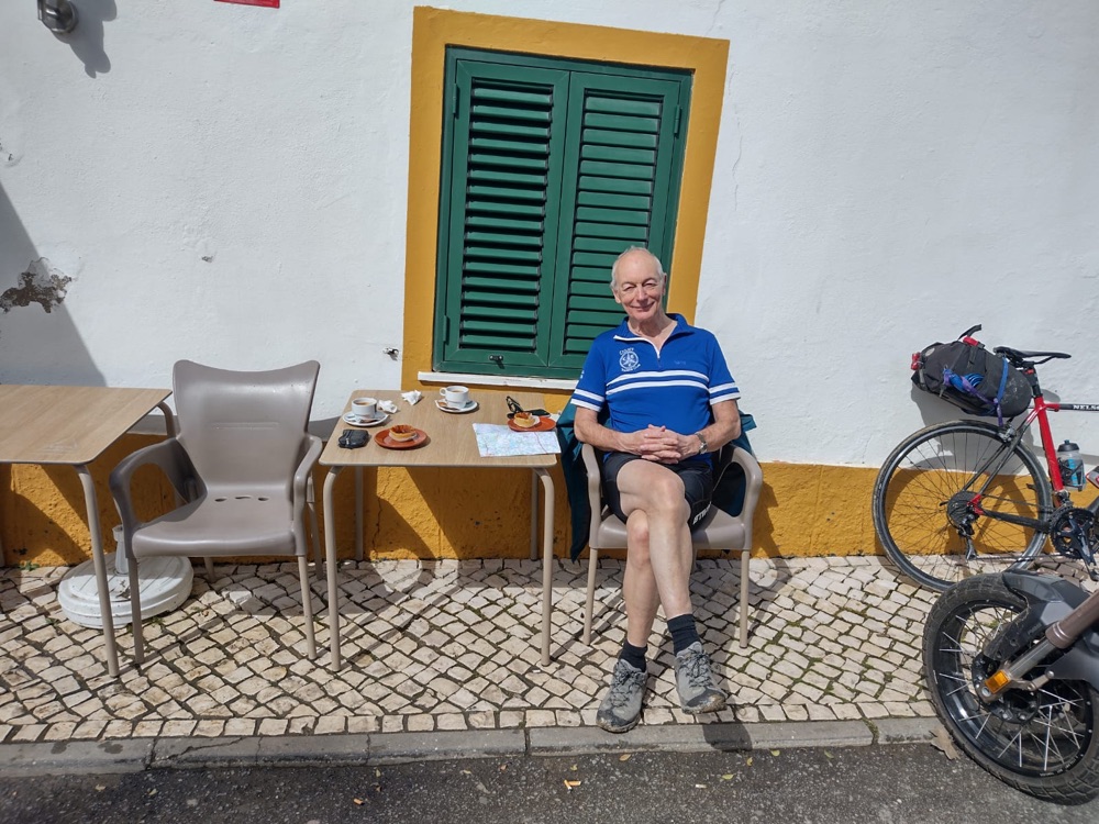
So on to a village called Aguiar where a little café was open. Coffee and pastries and seats in the sun, chatting with one of the locals.
Then the last 10 or so miles that we flew along.
We were on the N254. It was fast with quite a lot of traffic but it got us to Evora by 12.30 or so. I returned the bike to Galacio Bikes and back to the guesthouse.
Tropical rainfall all that evening so very happy we weren’t still out cycling.
The stats: 46.2 miles at 13.1 mph, with 2,938 ft of climbing. Max speed 32.5
Woken up by the sound of heavy rain on the street lamp outside my window. It was cold and grey.
And to breakfast, that of the Hotel Vila Verde being the best so far:
Juice, scrambled egg, bacon, yoghurt, banana and muesli all good but rubbish coffee.
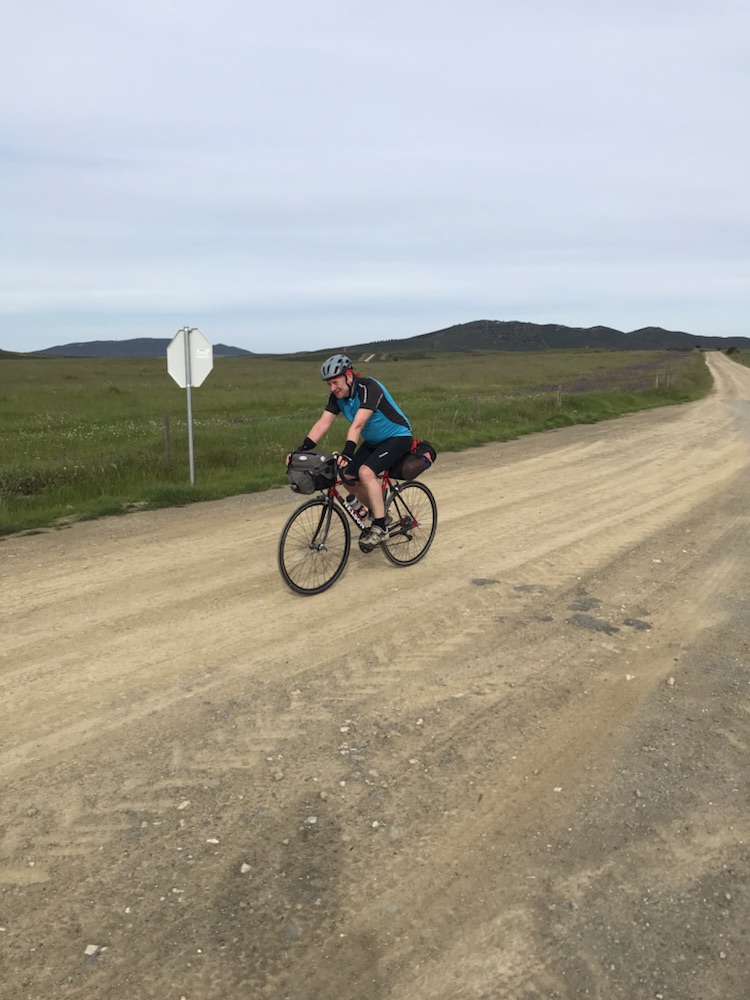
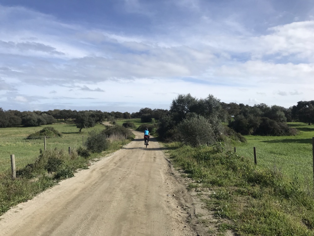
Off and out of town. Onto the old main road, now virtually unused, variable road surfaces (perfect tarmac to grit to mud to stones to ripped tarmac).
Amazing run as the first 15 miles are almost all downhill so very fast especially with the strong tailwind.
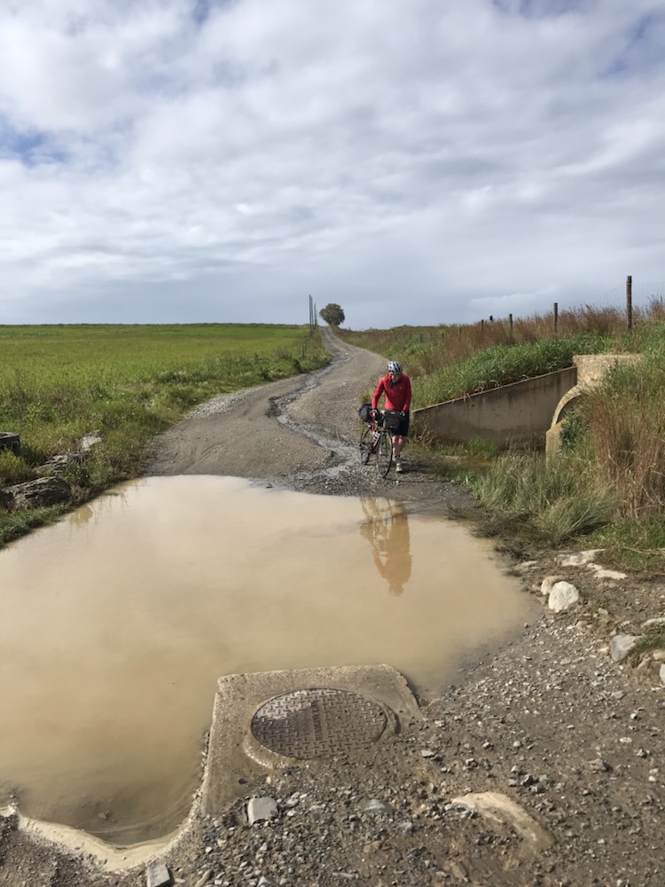
Some big puddles:
After about 2 hours the second big shower – this time horizontal hail for only 500 yards or so but got soaked.
The countryside is very different. Gone is the barren moorland of yesterday.
Now what appears highly productive fields of olive trees, vines and crops.We cycled along with orange trees lining some of the roads.
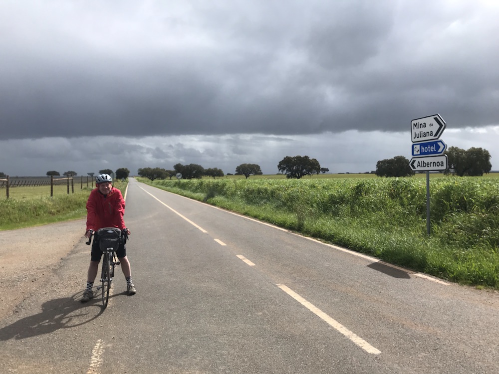
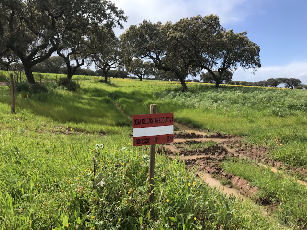
Deserted as ever.This sign is everywhere. It means hunting zone, like in France.
Just out of Santa Vitoria we turned into the right road after the usual navigational issues aka getting confused.
It was brand new tarmac and very smooth with just one problem; a sign saying the road was shut apart from at night.
We cycled along through lovely countryside for many miles and then came across the tarmac layers who fortunately weren’t bothered about us going through.
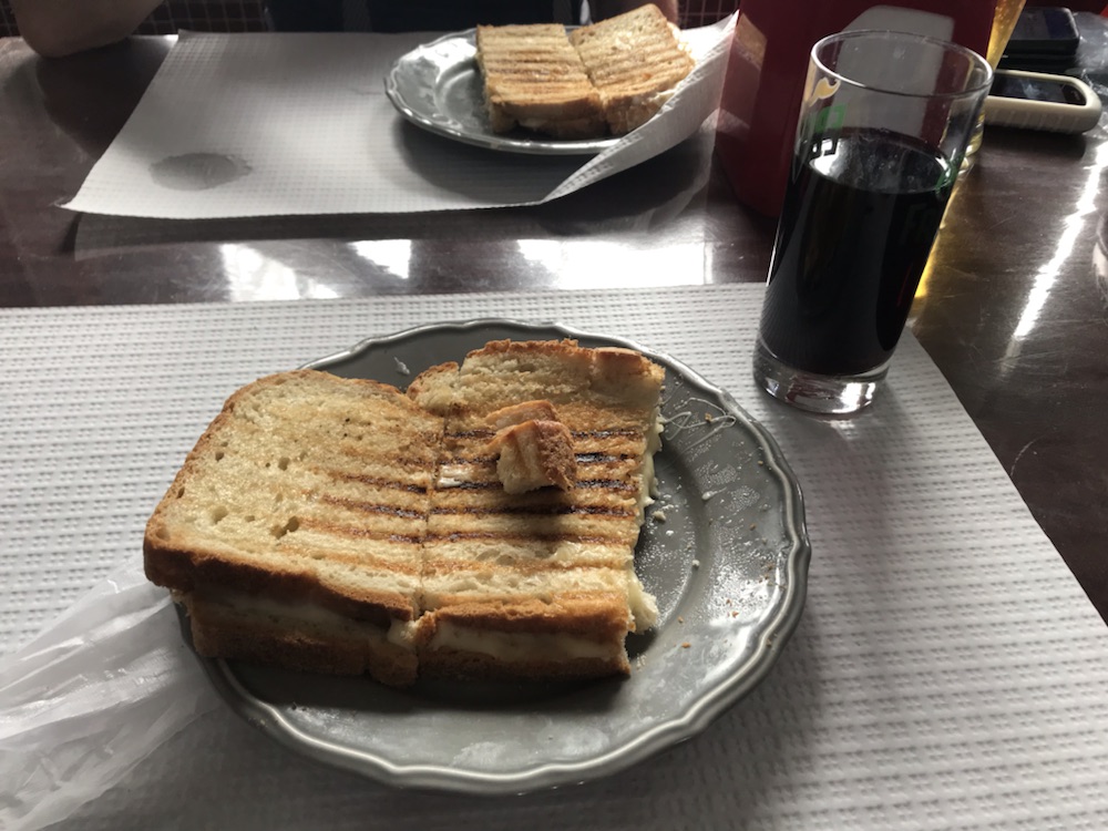
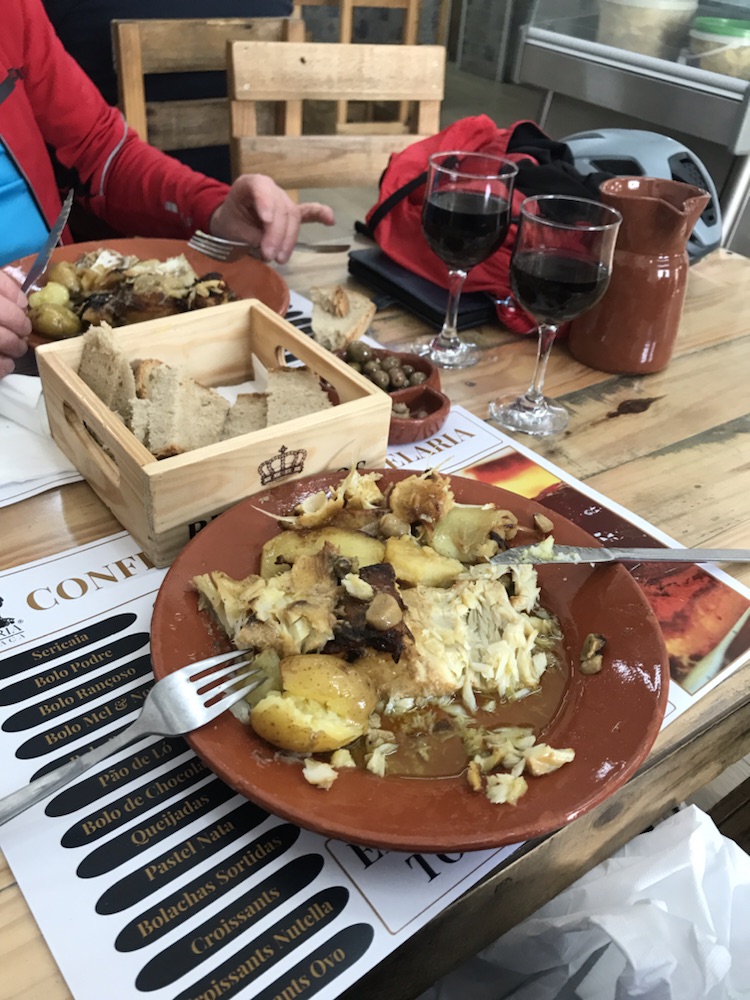
Into a little village called Beringel where we found a café for lunch:
Cheese toastie with a coke that tasted suspiciously like red wine.
The café like the others we have been to had loads of elderly locals in, like a local community centre which I suppose it is.
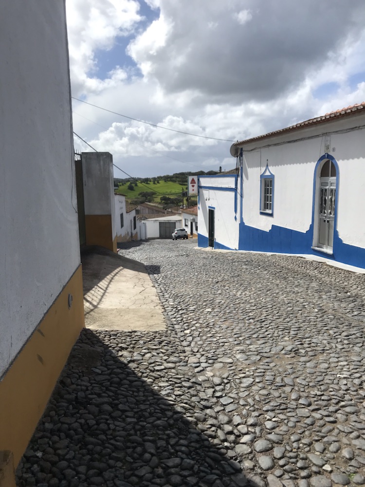
Typical small village scene:
More heavy rain when we were eating then the last 12 miles or so to Cuba and this:
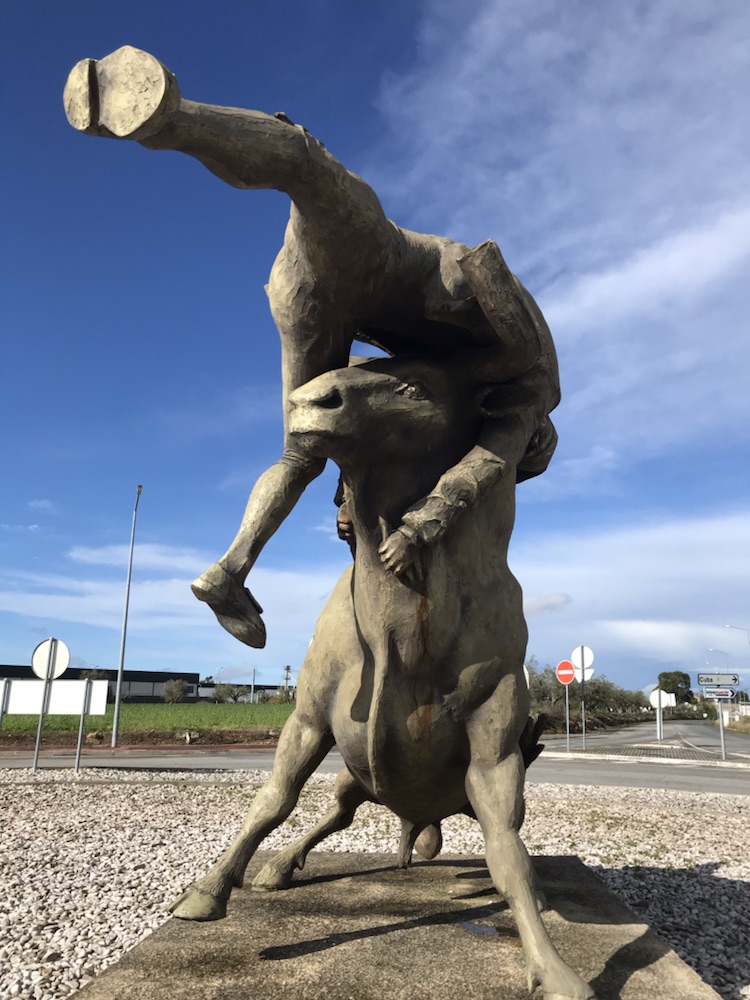
We’ve seen quite a few bull fighting rings in the small towns.
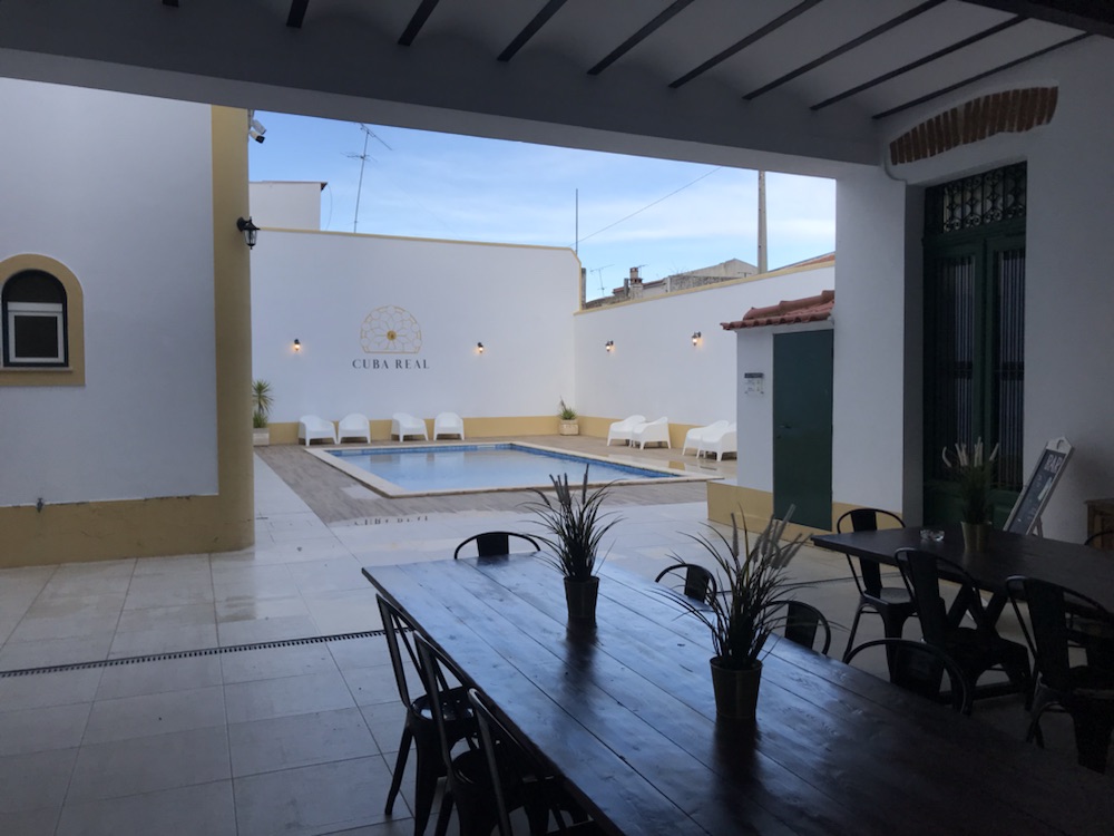
Eventually found our hotel, the Cuba Real. The best place we’ve stayed so far and it should be at €70 per room ( the Vila was €50 and Casa Serpa €40).
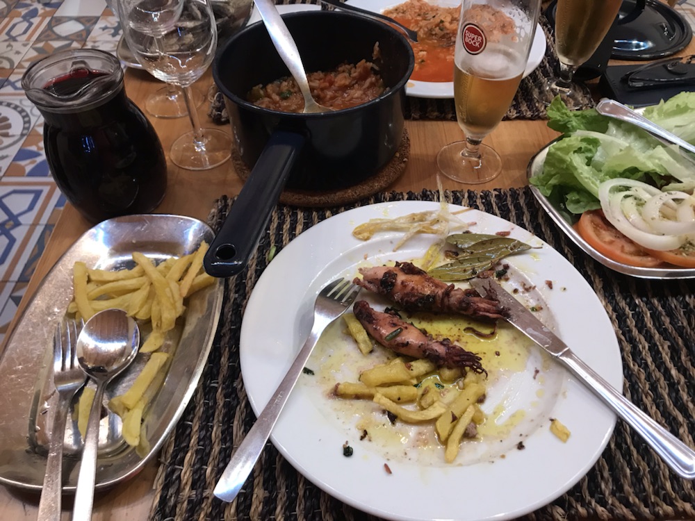
Off out for a couple of beers. John asked if we could eat in the bar and they showed us into their restaurant.
Excellent dorado with sauté potatoes, rice and salad and a bottle of local wine, plus olives, bread and pâté for just €27.
Now back at the hotel and the rain is pouring down…
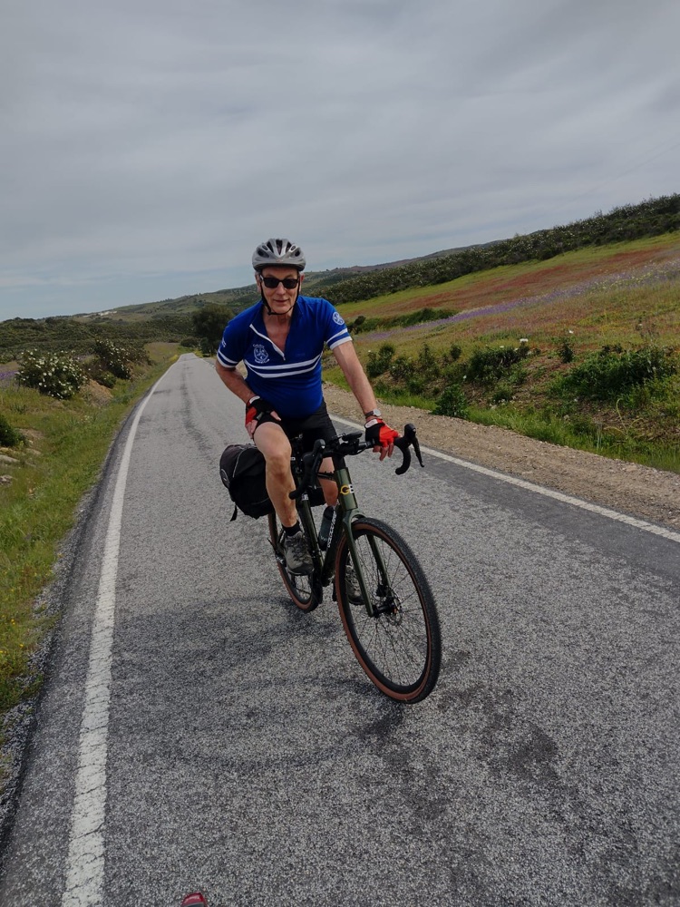
Lovely (apart from the dogs) sunny cycle in light winds.
Those stats:
43.8 miles at 12.8mph.
2,706 ft of ascent. Max 29.3 mph.
But first:
I do like a plastic flower in a pot…
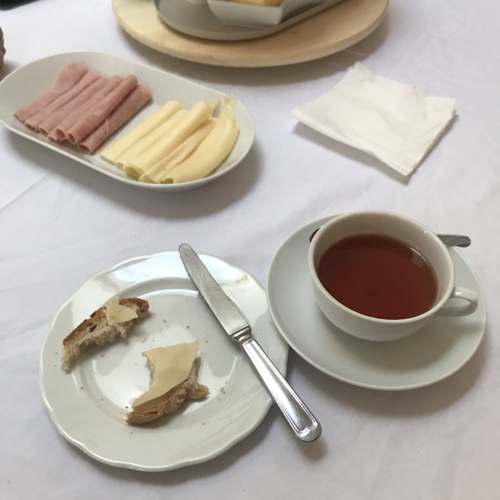
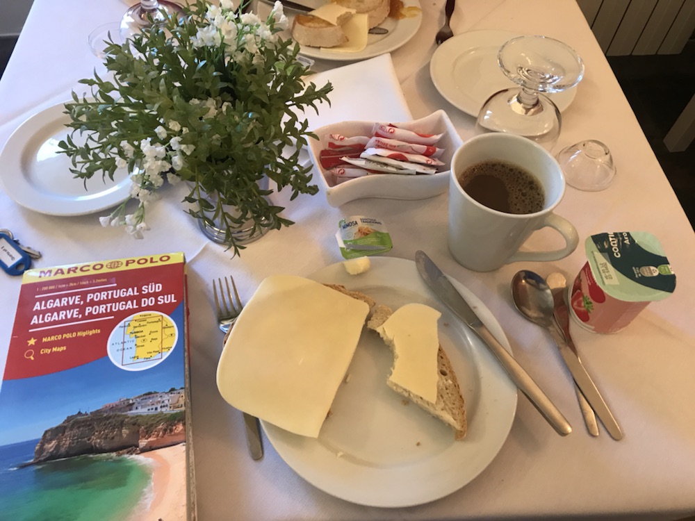
Basic but enough; coffee, yoghurt, bread, cheese. Still no eggs.
Off into the the rolling hills, but not before lots of faffing about trying to work out how to get out of this little town.
I blame Garmin’s aping. Sorry mapping.
But when we got out…
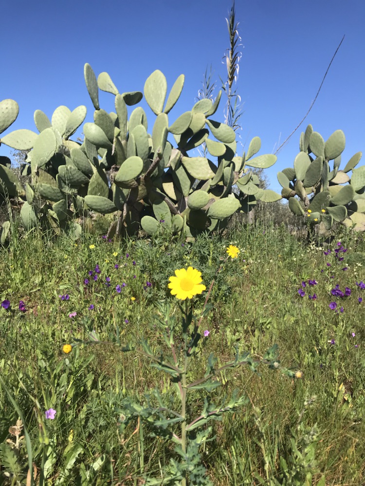
Brilliant roadside flowers.
We cycled south to Povoa de Sao Miguel, a 2 horse town on my Portuguese town grading system.
A steep slog up to a busy café where we had to have the custard pies with our coffee…
This was a lively place full of locals getting stuck into their pichets of wine. Well it was almost midday.
Lovely quiet tarmac road to Moura, another town on top of a hill with a castle.
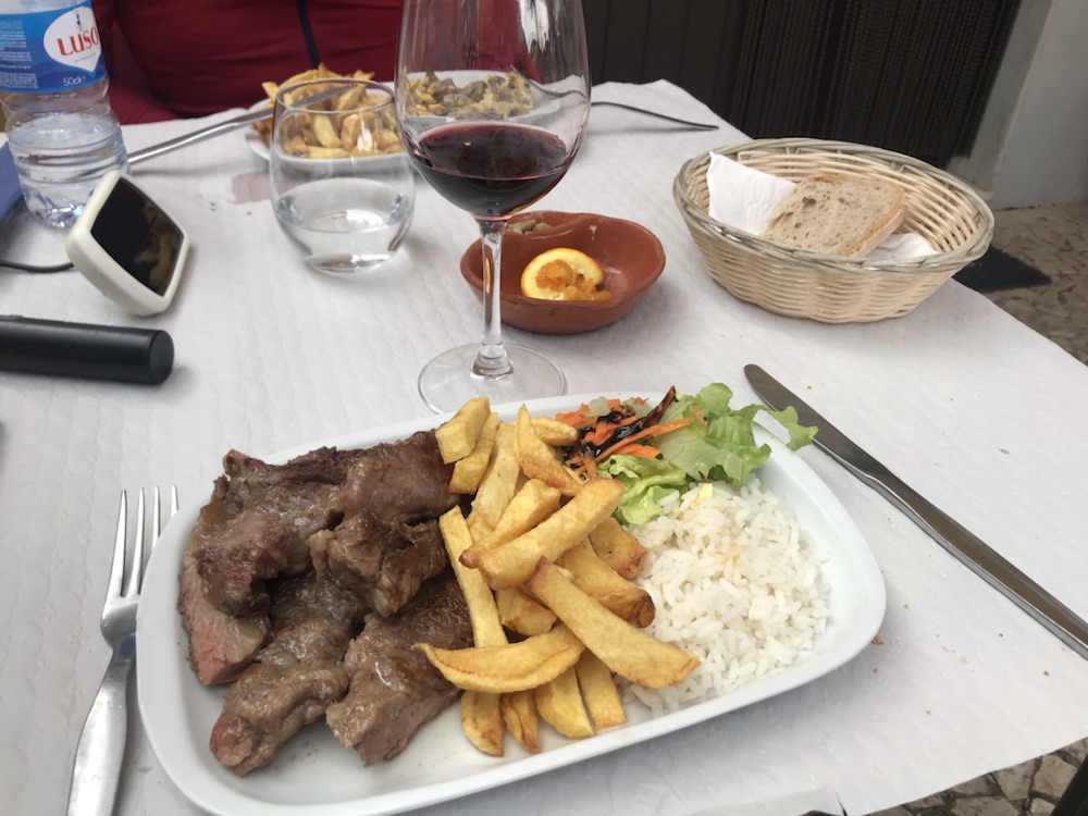
Great light lunch; I had local black pork with salad, rice and chips washed down with a glass of vino tinto.
Oh yes bread and olives too.
Then we left. But couldn’t find our way out of town yet again. Portuguese signposting is hopeless, as bad as our sense of direction.
The dreaded Garmin guaranteed if we took this almost unrideable dirt track for 200m it would deposit us on a local road which after a few miles would lead to cycling heaven.
But the local road was also a dirt track but worse as in the arse end of nowhere the locals let their ferocious mutts out to try and savage the rare passers by.
We were chased about 3 times and it was scary.
Eventually on tarmac to a little town called Brinches.
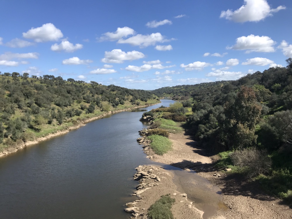
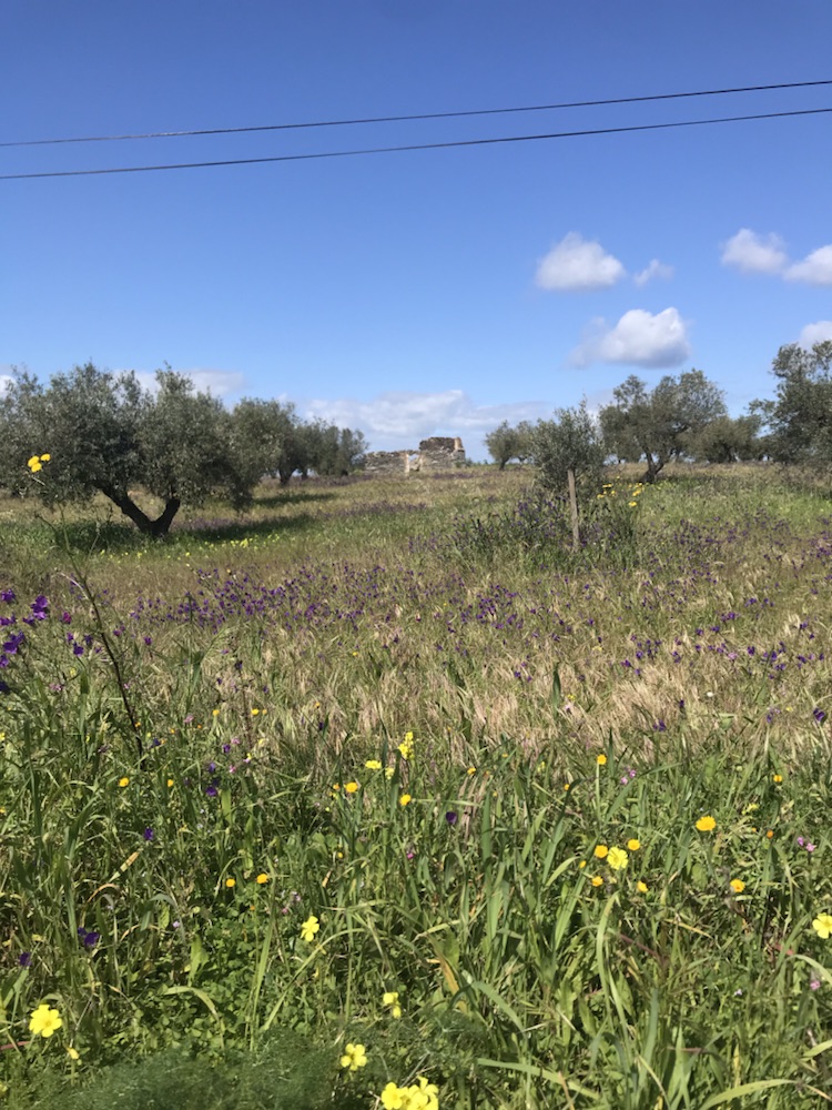
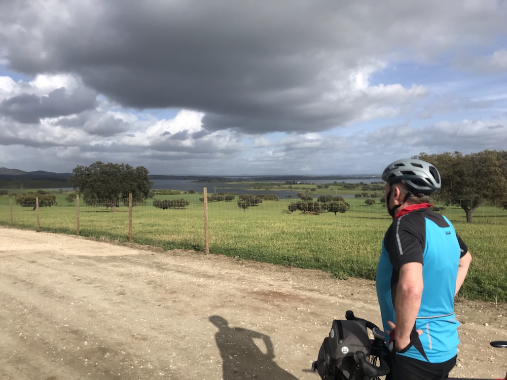
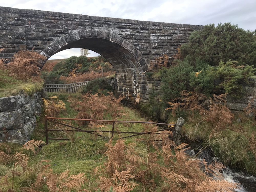
Another river, another bridge.Fields of olive trees and wild flowers…Taking on water
Roads really quiet – mainly agricultural traffic, tractors, pickup trucks and so on.
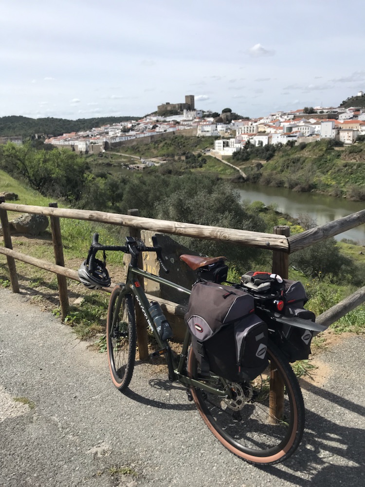
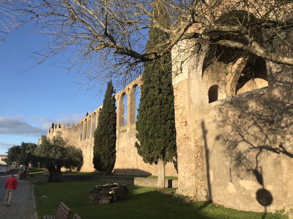
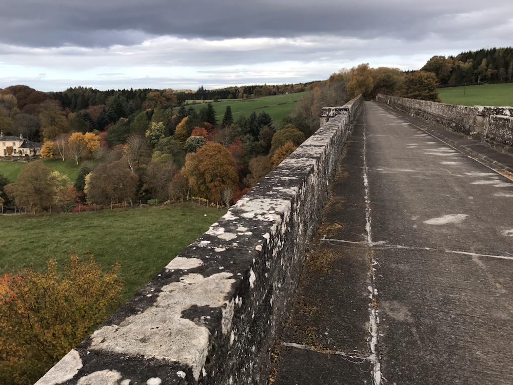
About 4pm arrived at Serpa. Lovely old town with castle, viaduct and town walls. We’re staying in Casa de Serpa, a guesthouse in the old town.
Like many places we’ve been through it seems depopulated. On our way back from supper there were very few lights on in a long street and I doubt they were out partying.
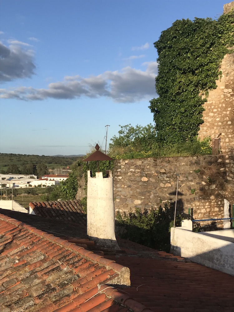
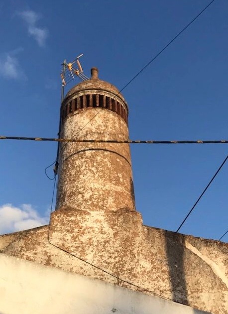
Chimney of the day.
A couple of beers in a square then to a little bar for supper.
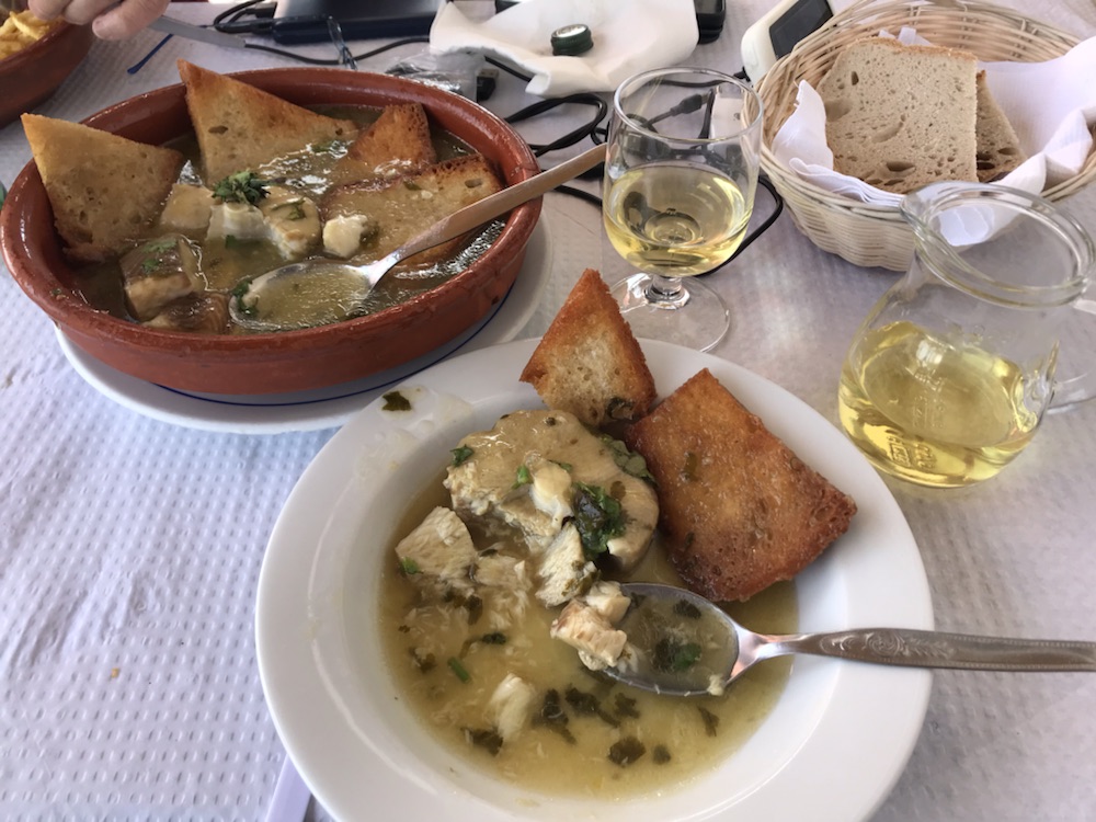
The owner recommended the local mushrooms which were excellent, cooked in eggs, olive oil and large bulbs of garlic.
Washed down for a change with a couple of jugs of vino tinto.
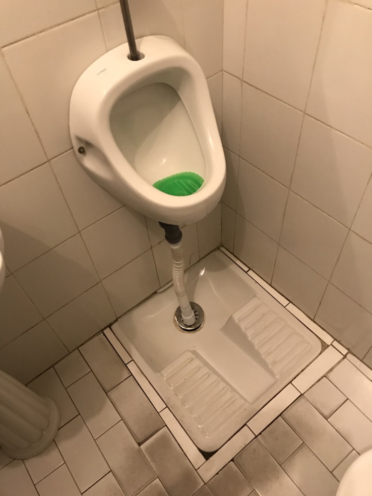
The loo was somewhat different…
For men who just have to miss. Just don’t try and squat in it.
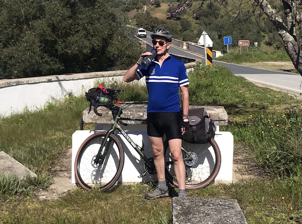
A road tour – first in ages – and to Portugal, a first.
A day of over eating and possibly a little too much red wine. Pleasant easy cycling so no excuse nor reason.
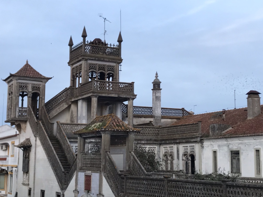
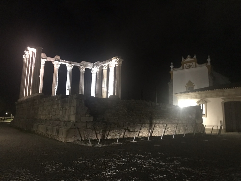
Flew to Lisbon then a packed train east to Evora on Sun where I met John P. Fascinating Roman ruins but seen only briefly as at night and livers to ruin…
The extent of the Roman Empire is amazing.
Anyway those vital stats:
47 miles at 13mph ! Fast !
Because it was flat- just 2,100ft of ascent and a following wind.
Max speed: 31.9mph.
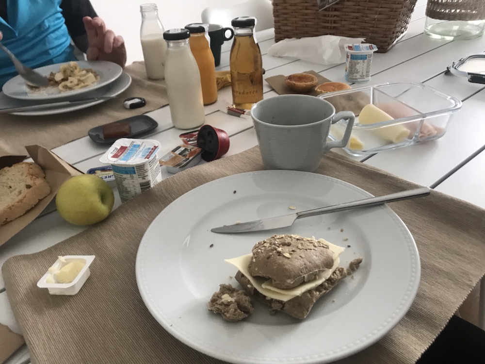
Powered by the Lavradores Boutique Guesthouse breakfast:
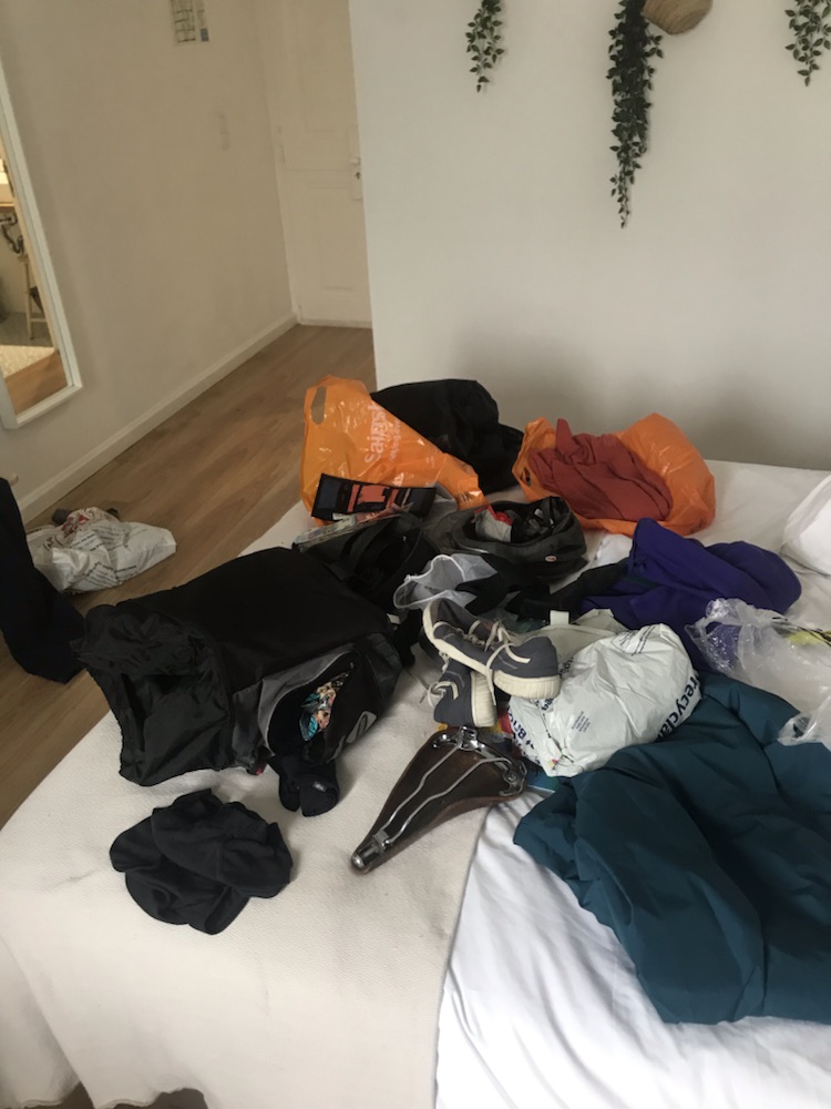
Pretty good. Roll, muesli, cheese, yoghurt, fruit, toast, excellent coffee. No eggs tho !Prepared my cycling kit in time honoured fashion. Threw it all over the bed then rammed it into Ella’s panniers. What I couldn’t fit in I wore.
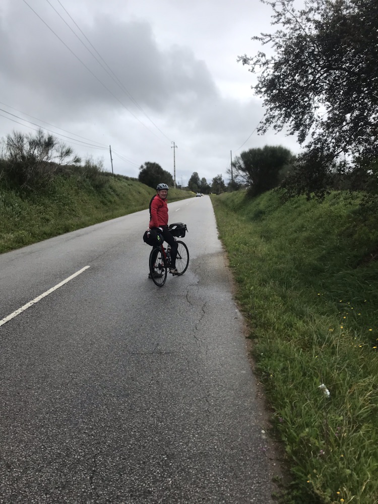
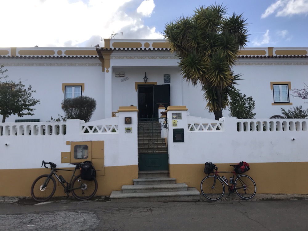
Off to Galicio Bike where I’d booked a gravel bike for the 5 days for just €150.
Lots of faffing around while they fitted a pannier rack, my saddle ( Brooks obvs for bottom comfort), Garmin, ‘phone holder pedals etc and eventually off around 11.00.
Quite grey, cold and drizzly at first not the 20C, sun and blue skies etc John promised.
And the miles rolled by…
Empty roads.Then on a great cycle track.
Which took us to Reuengos de Monsaraz. This, unlike the other villages we’d been through, was quite busy; a 3 horse town not a 1 horse one.
We found a little café and had the dish of the day; cod with potatoes in olive oil and lots of garlic. Bread and olives to start. Half a litre of surprisingly good vino collapso…
Excellent ! Nice place too.
Then the sun came out and the cycling was great, mainly along dirt tracks (classified roads here) with no traffic.
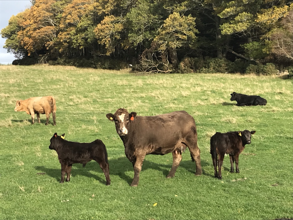
The miles rolled by, helped by the red wine. A few goats, cattle or sheep in the fields, not a person to be seen.
Idyllic cycling, lots of birdsong, and then in the distance our destination.
We picked up speed to outrun that rain cloud.
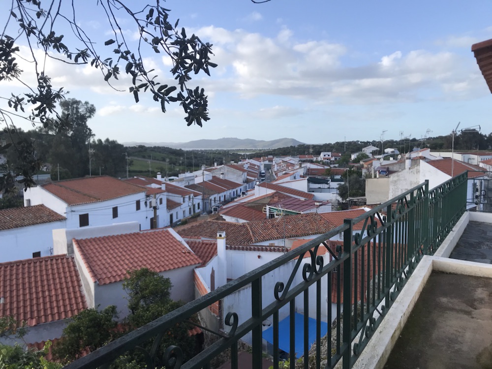
Into Mourao and some faffing to find the Casa Esquivel but eventually…
Thankfully did not have to push bikes up those stairs.View from the guesthouse.
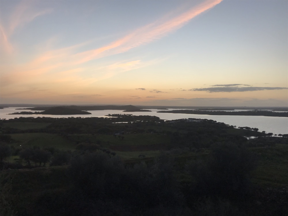
Off up to the castle for the setting sun over the lakes:
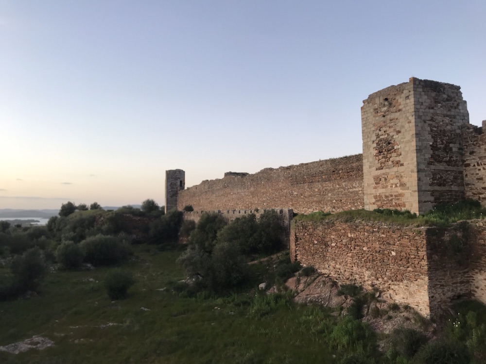
The castle sadly was shut but we walked around the walls. Just 5 miles from the Spanish border here.
After the Moors were kicked out the castle was renovated in 1296 (!)
Great chimneys:
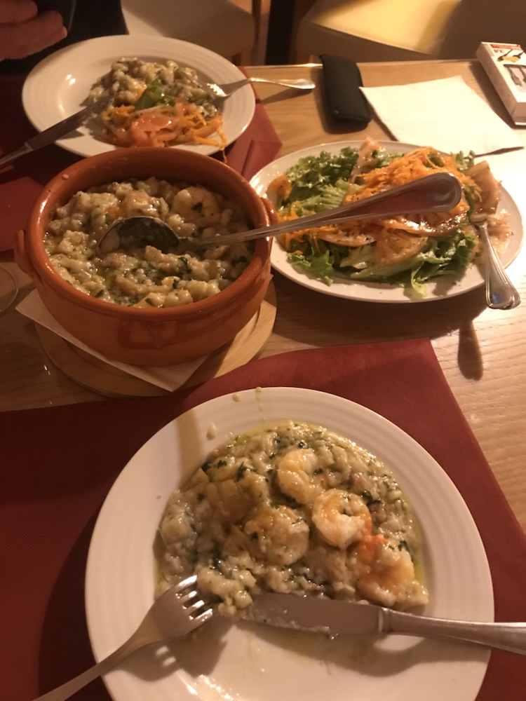
This town is very quiet. Eventually found somewhere to eat. We thought we were ordering tapas but the waitress explained the prawn stew was for two…
More like for four not two. We did our best.
And a good bottle of wine.
The day just got better and better. Southwards tomorrow .
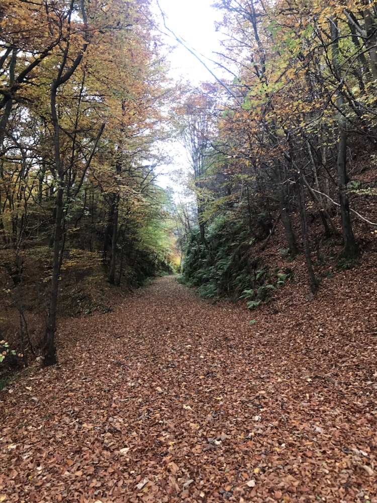
A very pleasant and easy cycle almost all on old railway tracks.
The final stats; the day was the shortest (25.2 miles), the fastest (9.9mph average) the lowest (climbed just 1,250ft) and the least time in the saddle (finished by 1.30pm).
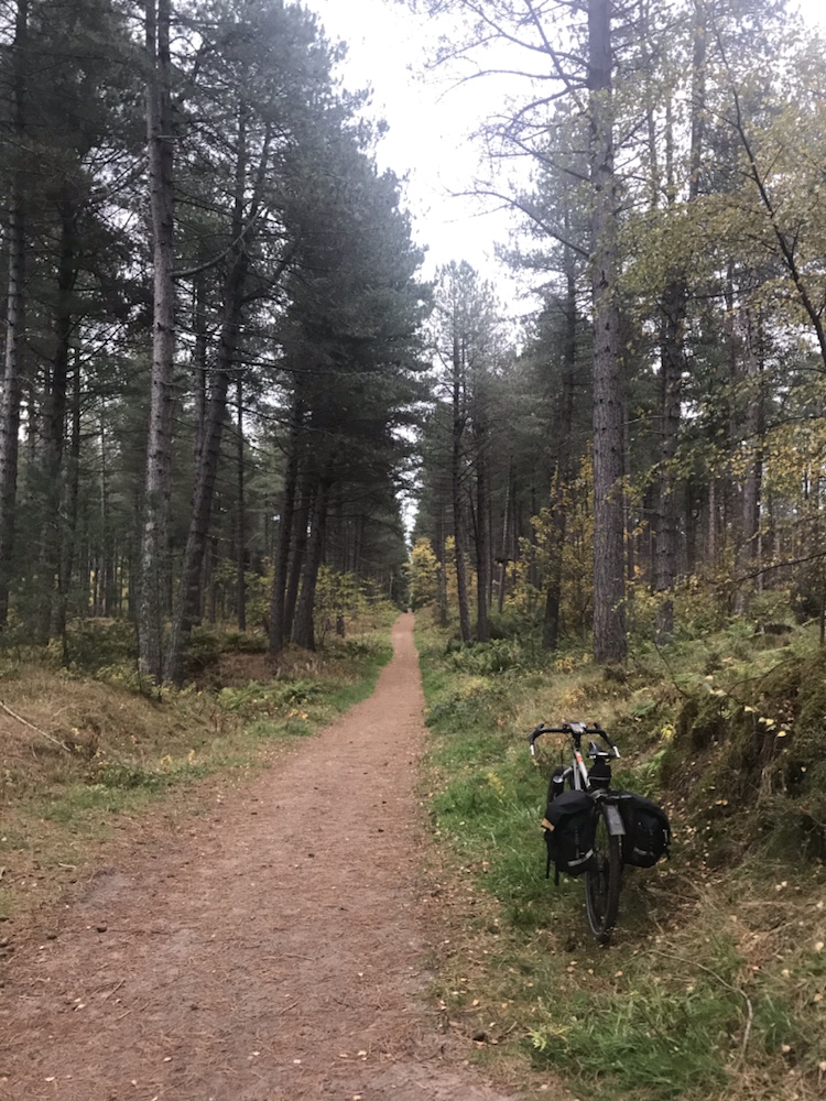
No breakfast pic I’m afraid. Tea and toast and off I went into the coldest and sunniest morning so far. Rather than repeat last night’s traverse of the dreadful A941 Hazel suggested the disused railway track.
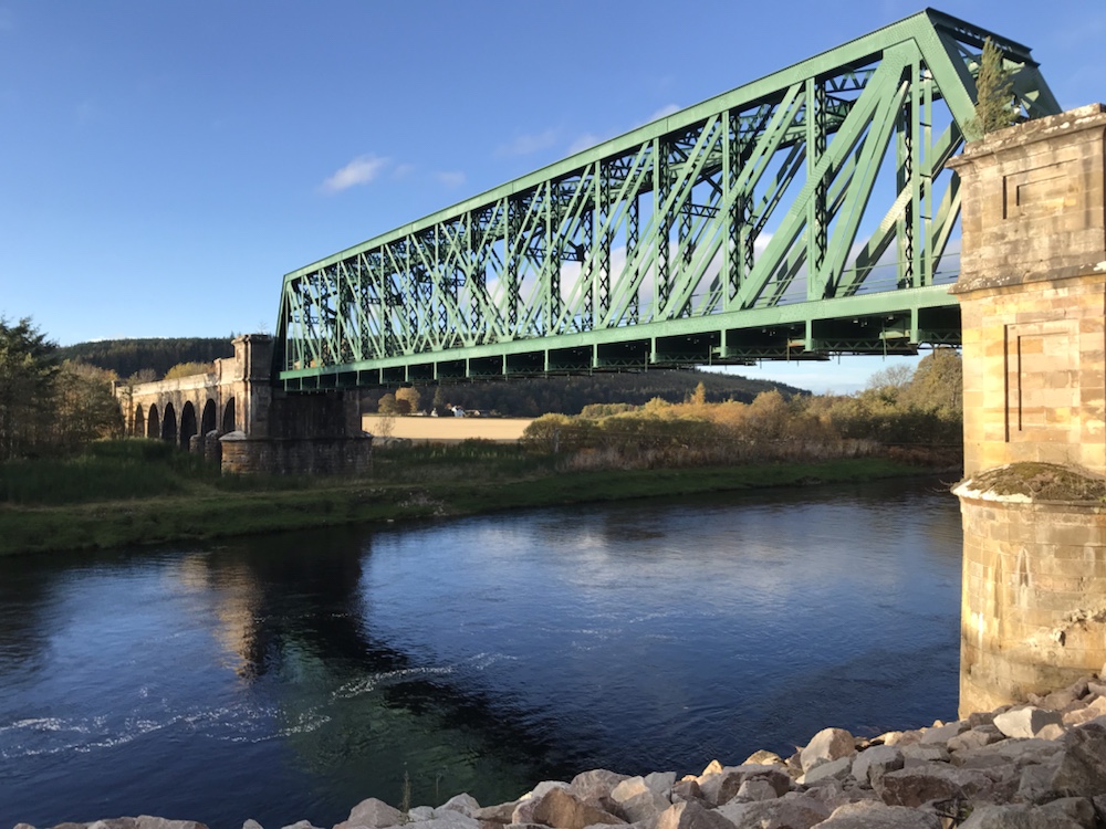
This is the old Strathspey Railway which, like the Inverness and Perth Junction Railway aka the Dava Way, was built in just 2 years and opened in 1863. It went from Dufftown alongside the River Fiddich to Craigallachie and then followed the Spey all the way to Boat of Garten.
It then was joined to the I&P J Railway, but shut to passengers in 1965 and freight (coal to the many distilleries and whisky from them) in 1968. Even at its peak it only broke even.
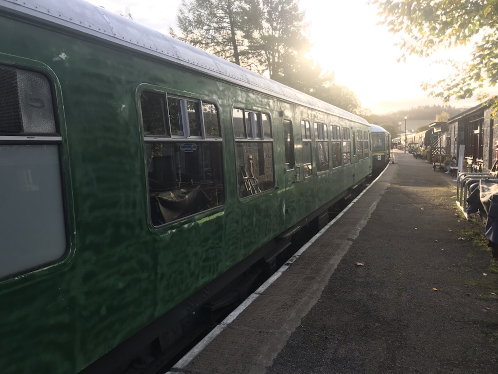
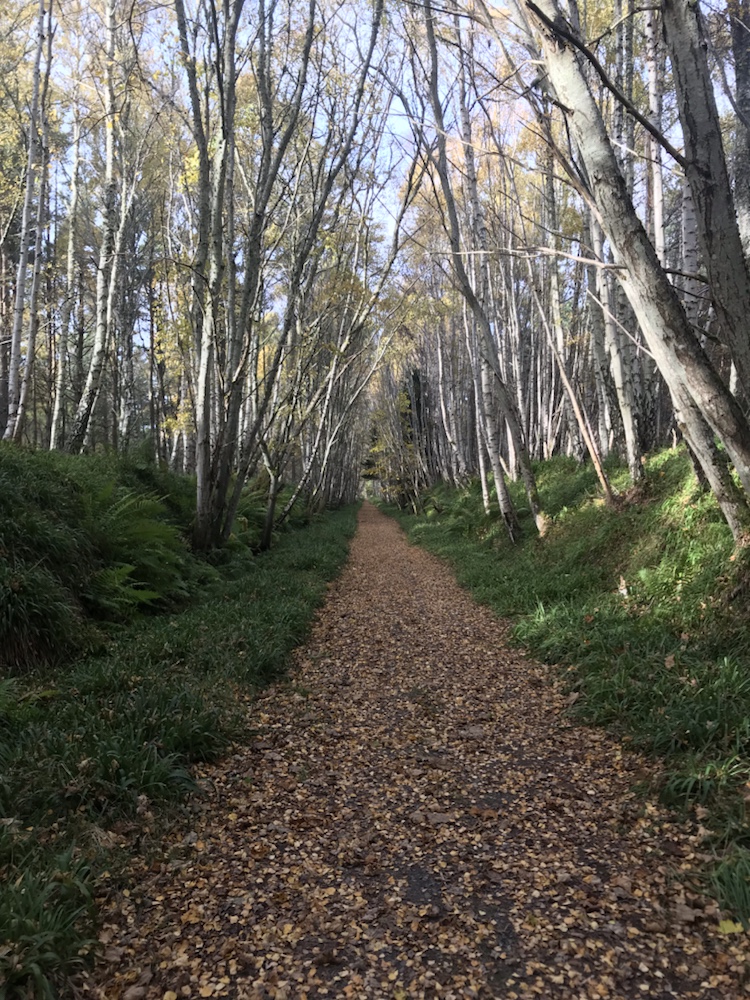
The Dufftown-Keith line, which goes in the opposite direction, still runs as a heritage railway, now 150 years old. I cycled out of Dufftown for a mile or so and on to the station platform …
The train now at platform 1…
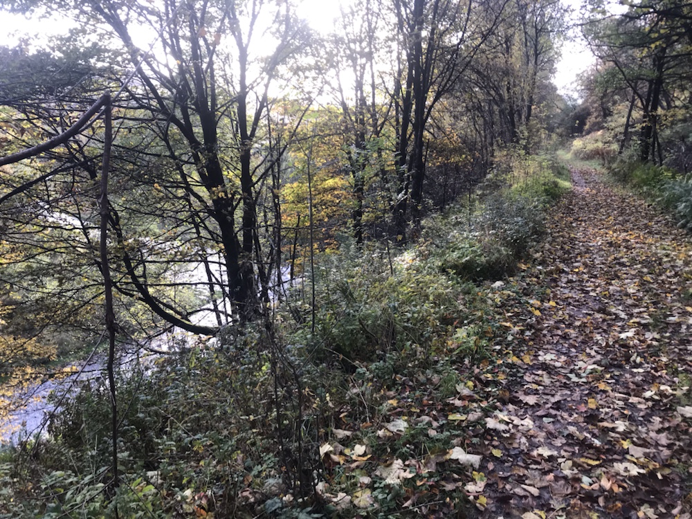
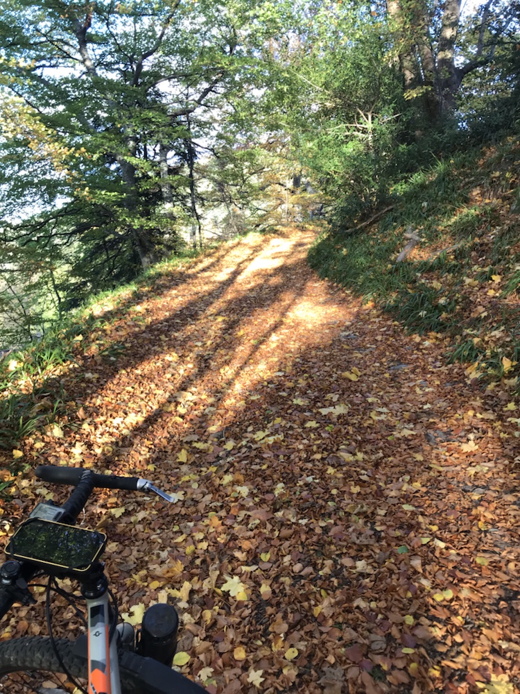
At the other end of the platform the Strathspey track starts. It’s a great track that gradually (very gradually) descends to Craigallachie. A delight to cycle in the autumn sunshine:
Above the River Fiddich.
I saw just one person on it in about 5 miles. The scenery changes as it passes through cuttings and across fields up on embankments.
Such a great route to an excellent pub.
High above me to the west was a large hill along the top of which runs the A941. If only I’d known about this last night..I’d have had another pint!
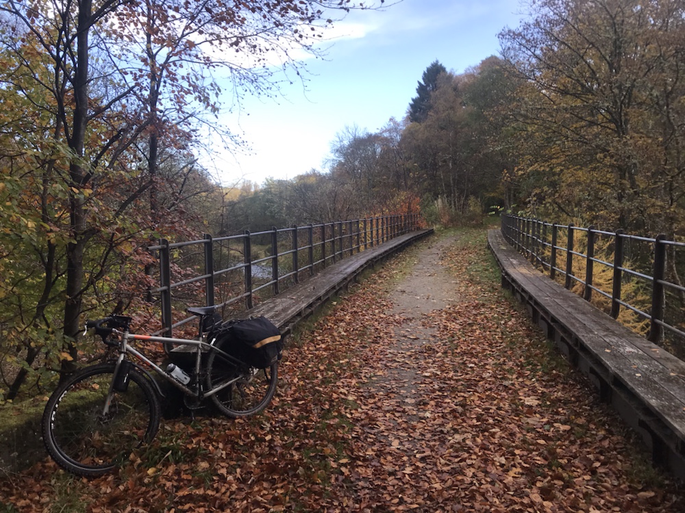
One of a couple of bridges.
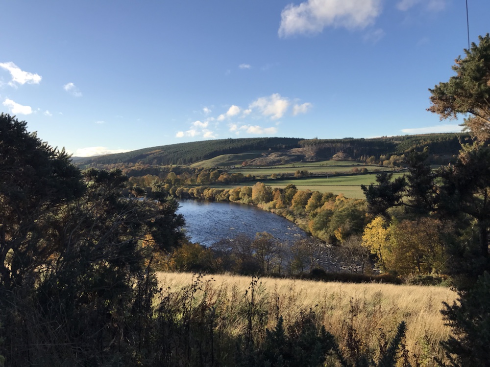
I then went through Craigallachie and on to Aberlour, where I got some provisions. The track goes alongside the Spey here:
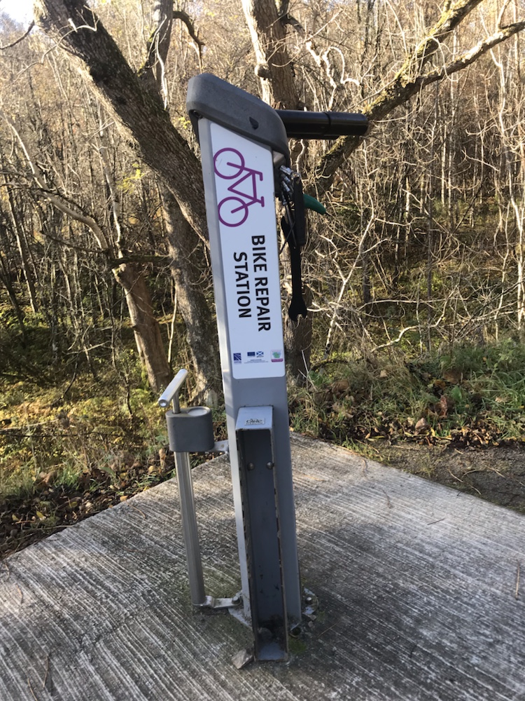
Lots more people about now, walkers mainly with dogs and cyclists (without dogs). Saw a recently installed bike repair station, to encourage low carbon travel around here.
All the tools you could want…
Some miles further on I sat on a bench for ages in the sun, ate a samosa and read my paper. Total silence.
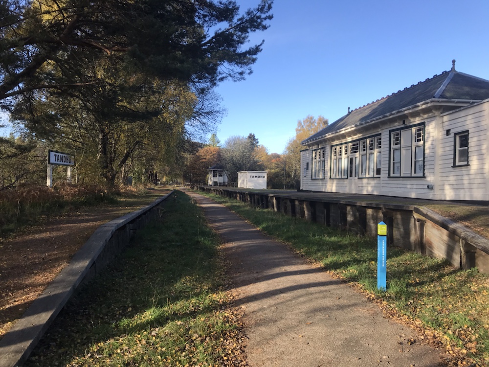
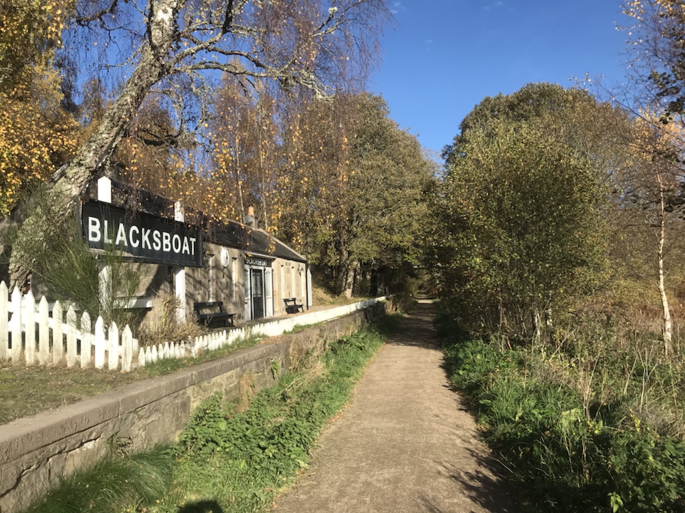
Eventually I started off again and passed through more stations – there are 10 between Dufftown and Ballindalloch, the majority connected with the distilleries, such as Knockando, Tuilane and:
Tamdhu.
Bizarrely on the old platform here and at Blacksboat there are signs saying “This platform is not a playground. No…etc etc”. Why? Do they think a train is about to rush through?
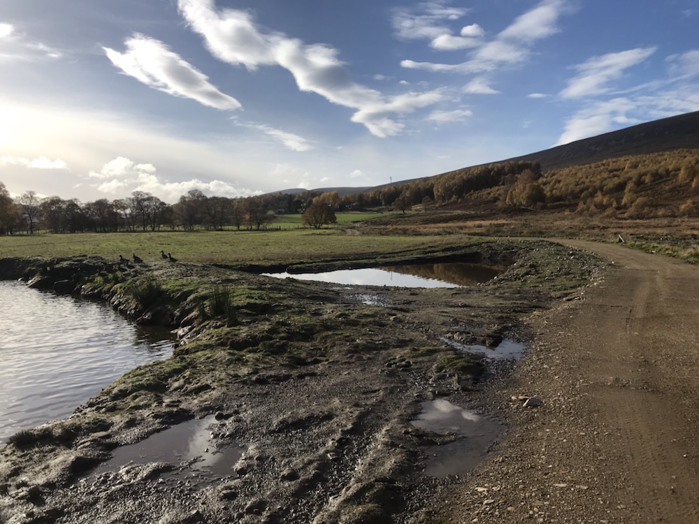
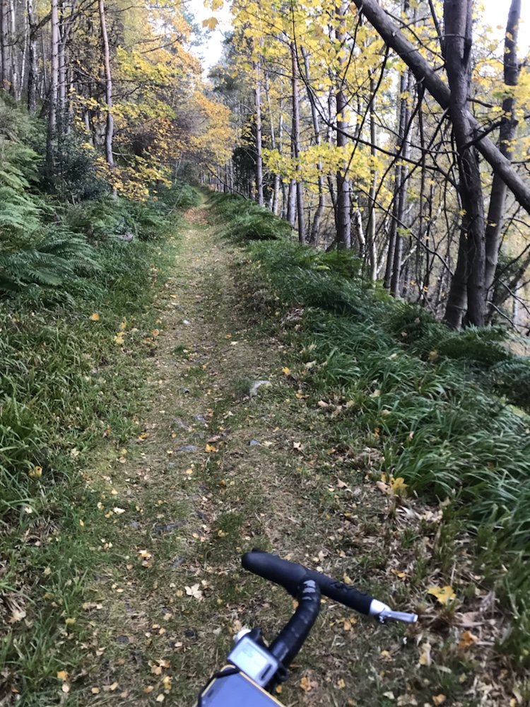
I didn’t want this delightful cycle to end but it had to at Ballindalloch where I was back on the tarmac for some miles to follow the back road to Chapeltown and then off road to Alltnaha:
The duck pond .
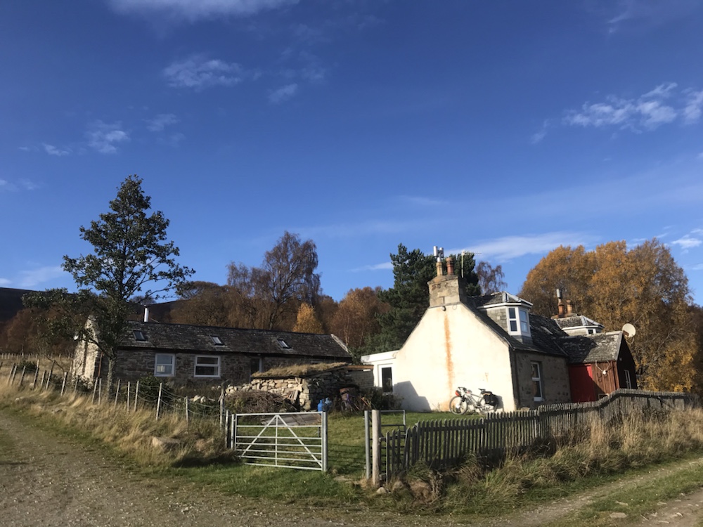
Across the burn and home:
Must paint that gable wall…
This has been a great trip. I’m glad the hardest day was followed by the easiest. I would not have enjoyed another tough day! To my surprise the best bit was the Dava Way for the variety of scenery and the sense of history.
The toughest part was the Moray Coastal Trail but that really is meant for walkers and not bikes, so what I should expect I suppose. The weather didn’t help that day either.
Apart from the woods at Ben Aigen, I think this would be quite a boring, but easy, walk.
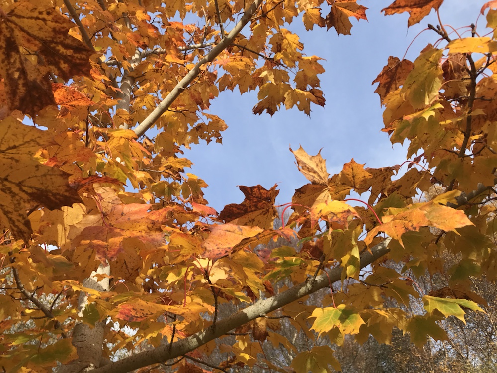
The autumn foliage colours were the best I’ve seen in years, apparently because of the summers heat/drought. I was also lucky with the higher than usual temperatures.
Next off road trips…Badger Divide (Glasgow-Inverness) or An Turas Mor (Glasgow-Cape Wrath) or both?
A hard day’s ride with lots of variety in the weather, scenery and tracks.
And the stats; 52 miles at 8mph. Slow due to the ground – sand, shingle and then mud.
Ascent: 4,026ft, almost all at the end. Max only about 20mph.
But first breakfast:
Tea and yesterday’s cheese roll. But miserable, like the weather.
This pub does not do breakfast. Nor does anyone appear when you leave which was a bit odd. Off to the village shop for food and then the start of the trail.
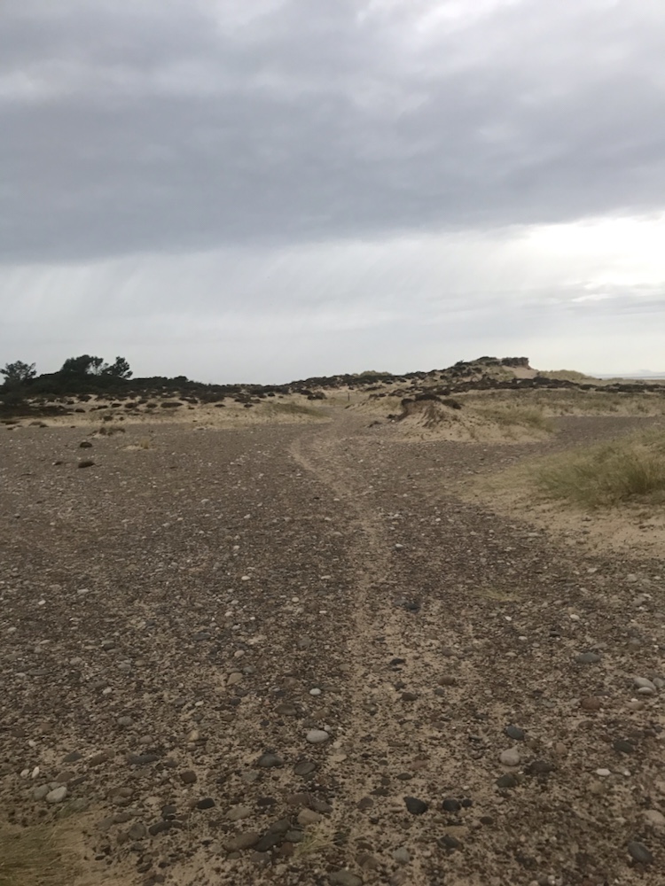
Fortunately it is well way marked as it is hard to discern the route through the sand dunes and shingle.
Gloomy morning.
The light gradually improved and the shingle turned to sand which was not an improvement.
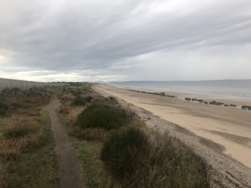
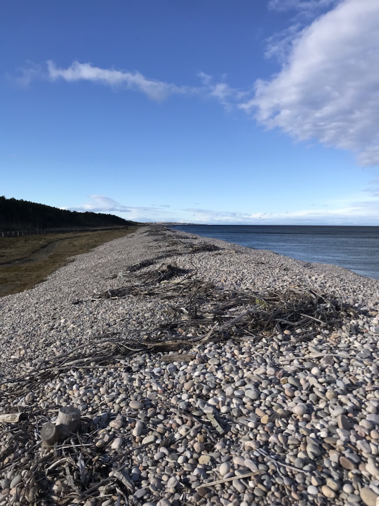
Miles of beaches and as ever almost deserted.
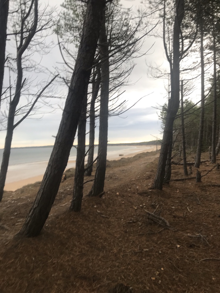
Most of these beaches are fringed by pine forest:
Looking east towards Burghead.
Then into the forecast for easy cycling on good tracks:
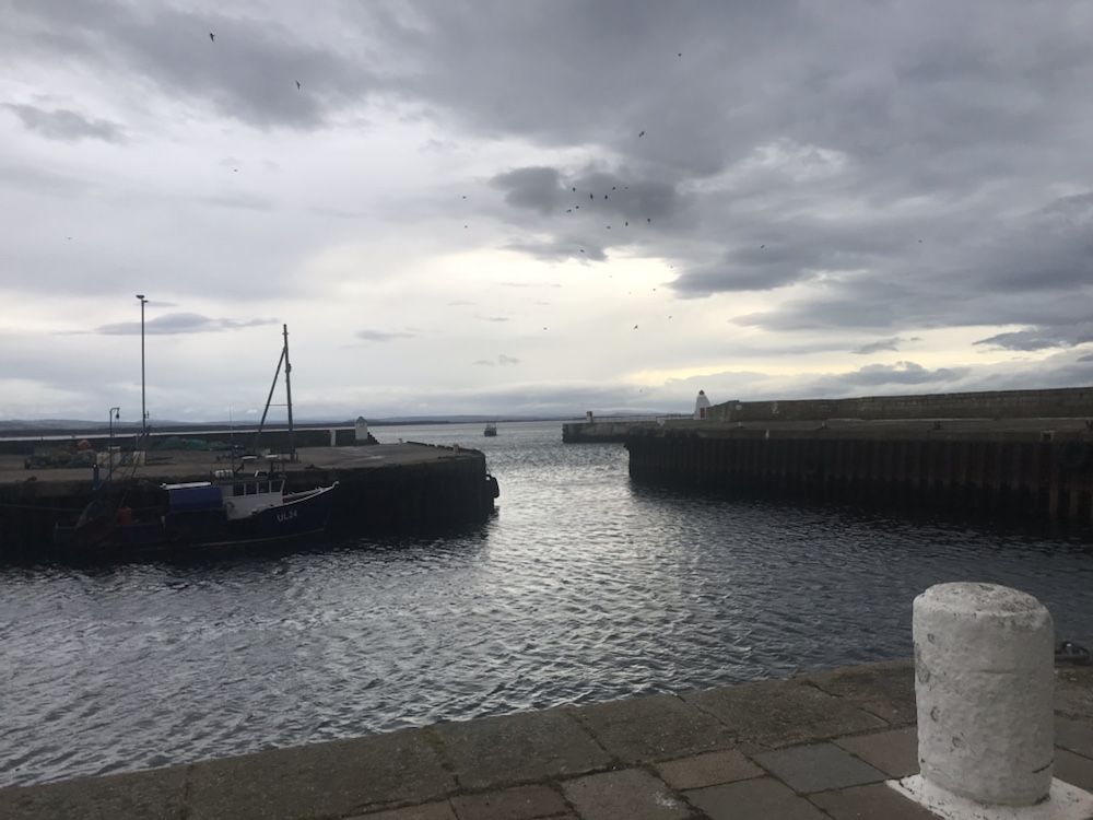
And after 6 or so miles into Burghead and it’s harbour :
Trawler about to enter.
This was the largest Pictish site in Britain by 900 AD. Their harbour was dismantled when the current harbour was built – designed by Thomas Telford in 1805. Was there any civil engineering project he was not involved in? He must have been the most prolific engineer in the UK.
The harbour has a memorial to the Shetland Bus; a group of very brave Norwegian sailors who via 2 fishing boats secretly ran men, ammunition and other supplies to the resistance in German occupied Norway in the early 1940s.
The wind started at Burghead and it was strong. Fortunately the trail to Hopeman was mainly in a cutting – another old railway track – and so not too bad.
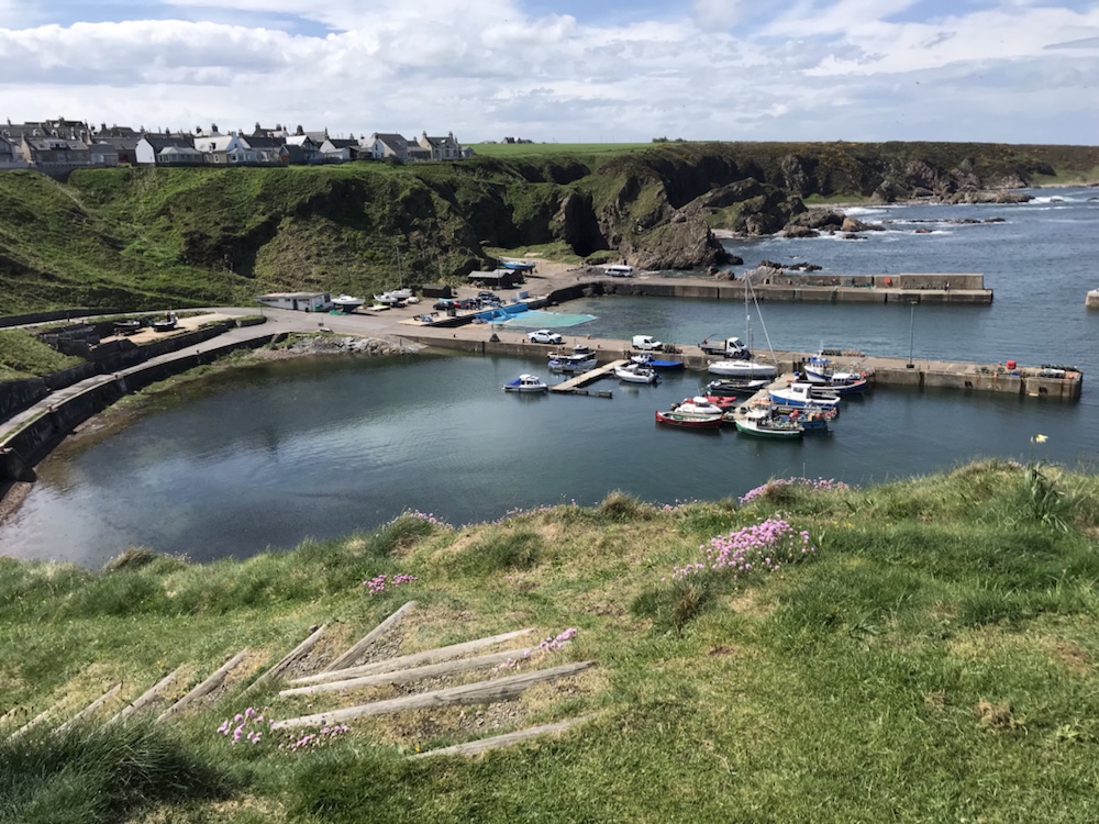
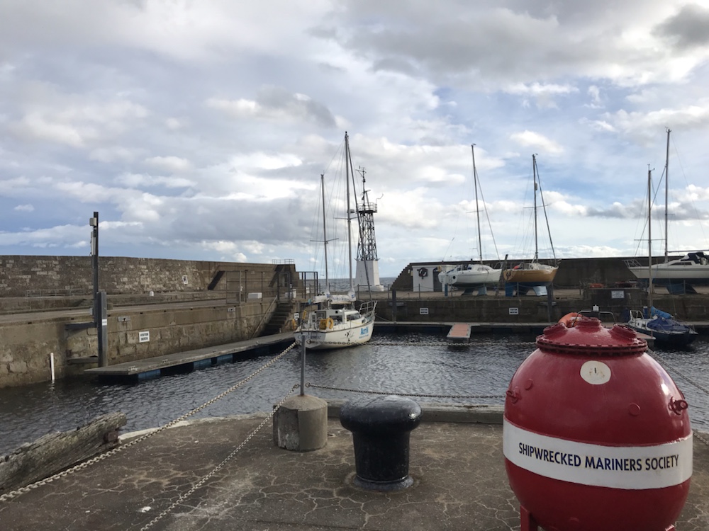
Hopeman has a lovely little harbour:
This was last summer as it doesn’t look so good in the grey gloom!
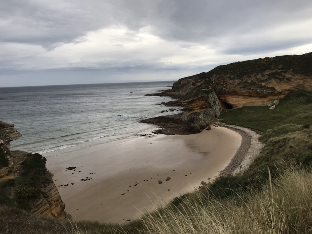
Lots of lovely bays albeit in the subdued slow dawn they didn’t look quite as scenic:
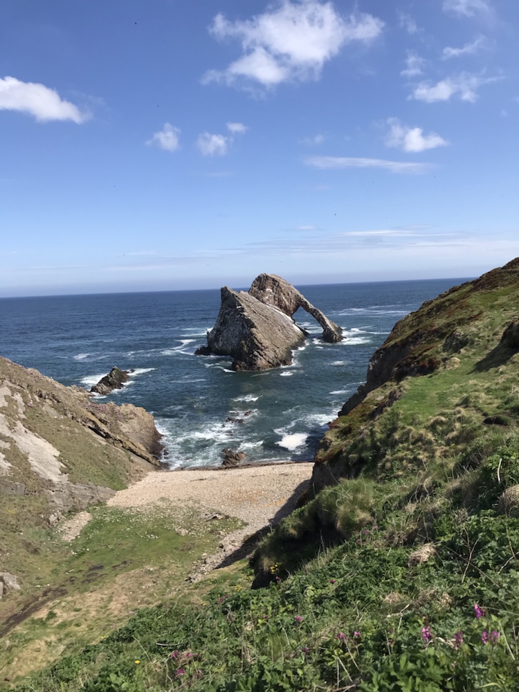
But this coastline is, especially when sunny, stunning:
Bow Fiddle rock. Last summer.
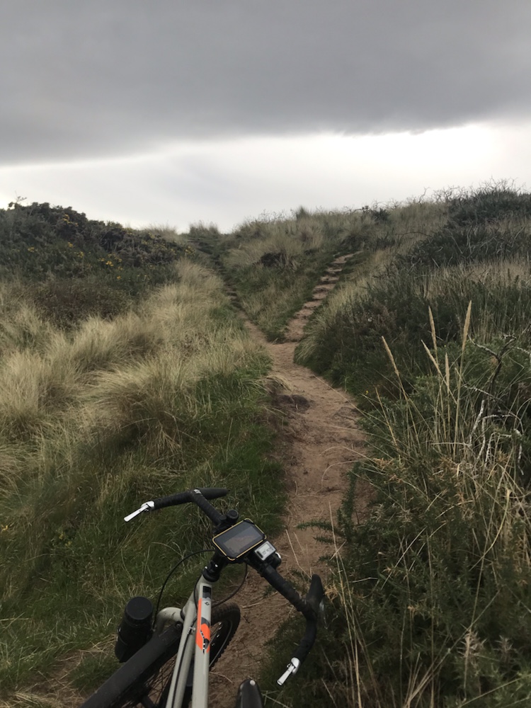
The track got harder with lots of pushing:
Slow. V slow .
It was taking me ages to get to Lossiemouth so I veered inland onto tarmac and a difficult headwind. That meant I missed seeing Covesea lighthouse from the beach but I also needed food.
So to a café we often visit; the Harbour Lights in Lossie harbour. After excellent coffee and eggs Benedict back into the headwind – gusting up to 40mph so progress was frustratingly slow.
The harbour entrance in the distance where Ella and I caught fish.
Back on to the coastal trail. There’s a new footbridge to the brilliant Lossie sand dunes but in that wind I thought best to aim for the tracks through the forest behind the beach.
The heavens opened and I must admit being tired, with that viscous headwind and the prospect of getting soaked and to top it all 30 plus miles still to cycle I was not happy. In fact I was very pissed off.
However it was a sharp shower and the sun came out. I wizzed along some great forest tracks shielded from that wind. But I felt I was a bit of a fraud away from the beach so back to it…
Miles of this.
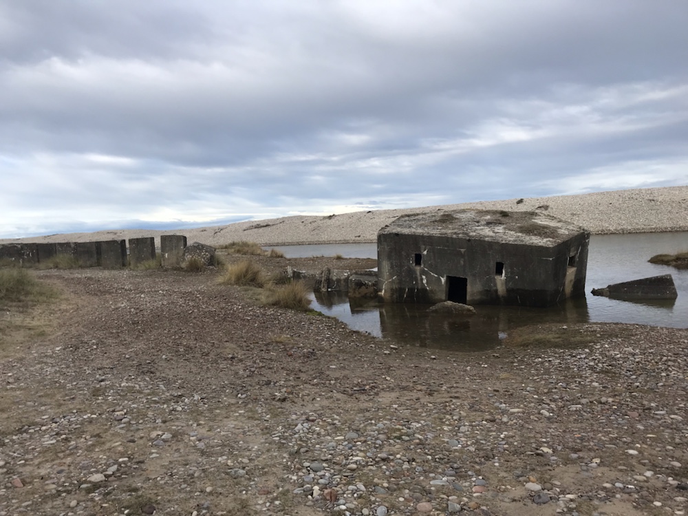
This was also where a German invasion from Norway was expected. Hence many pill boxes :
Just one of the 19,000 built in WW2.
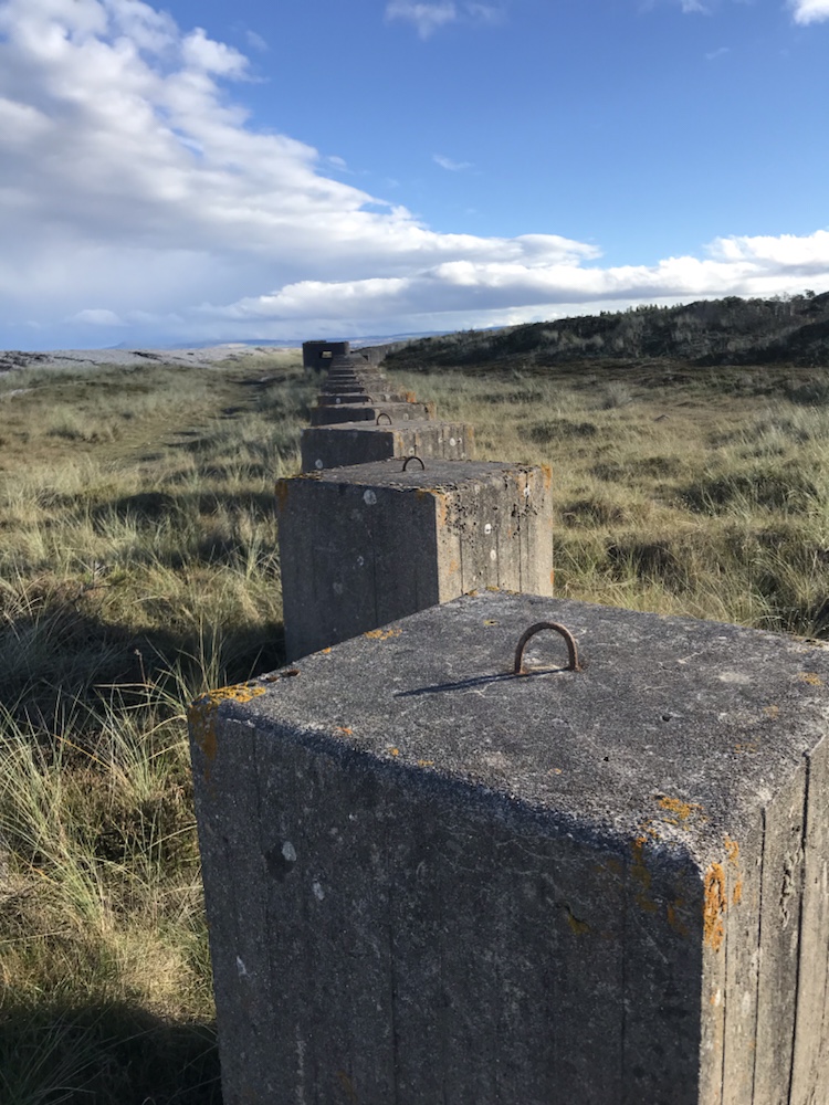
And tank traps which line the beach for mile after mile:
Not 19,000 like the pillboxes more like 19 million…
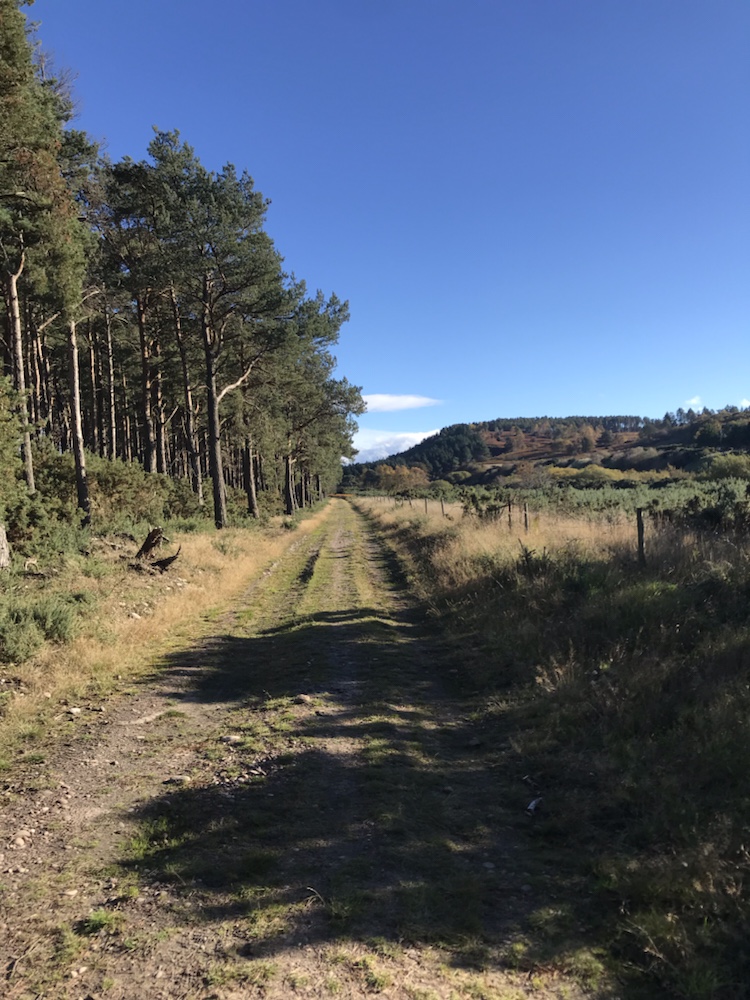
But the shingle and sand took its toll so back on the forest tracks:
Easy cycling in the sun. Just a few gusts. Like every 5 mins.
Eventually I got to Garmouth, a village by Spey Bay where the Spey runs into the Moray Firth. It was eerily quiet and quite twee in a well off way with Farrow & Ball everywhere.
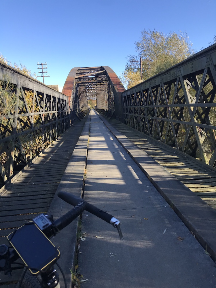
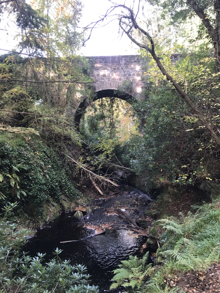
Then I knew I was easily half way. Across an old railway bridge:
And on to the Speyside Way. Well signposted but frankly a bit boring. Glad I wasn’t walking it. Through Fochabers and along a quiet lane with a viscous descent and ascent at Aultderg.
Then to Boat o’Brig and a railway bridge still in use for trains !
I knew I had some climbing still to do but it was far harder than I anticipated. Up a rough track:
Brilliant autumn foliage
Great views in the late afternoon sun:
The Spey. What else ?
But the track was not the usual wide good surface forestry track for log hailing lorries. It was steep, mainly muddy and the setting sun in my eyes did not help.
I saw no one for mile after mile.
Eventually I contoured along the side of Ben Aigen until the descent started – which was now on good forestry roads and then a lane which over the course of several miles took me down to Craigellachie.
Setting sun on the way down.
This was exhilarating, fast cycling and even better took me to one of the best pubs in the area; the Highlander. I was knackered and knew I still had 5 miles to do but also knew those miles would be reduced by consuming 2 pints of one of my favourite Scots ales, Deuchars.
Suitably refreshed and stoked up with 2 packets of peanuts off along the A941 to Dufftown. A long slog of a climb up and then down, in the dark.
But a warm welcome when I got to Hazel and Neil and a great evening with them.
A great day’s cycle, mainly off road on the Dava Way, an old railway line, north to the Moray Firth coast.
Those stats; 50 miles at 9.7mph, faster than usual due to less climbing and a good surface.
2,426ft of ascent – over 3,000ft of descent. Max speed 33.7mph. Hills walked up; just a couple of tricky slopes.
Usually I’d post a pic of breakfast but I was so busy getting ready I forgot. I set off into a grey gloom. Forecast was cloud all day but a strong tail wind. Neither turned out to be correct.
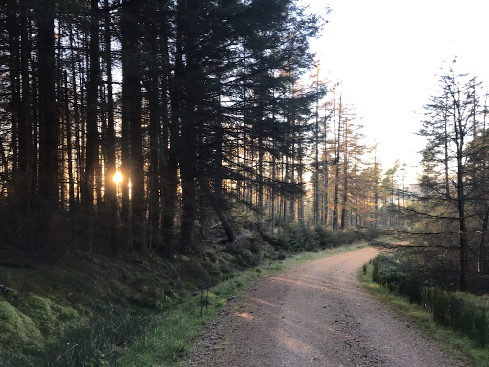
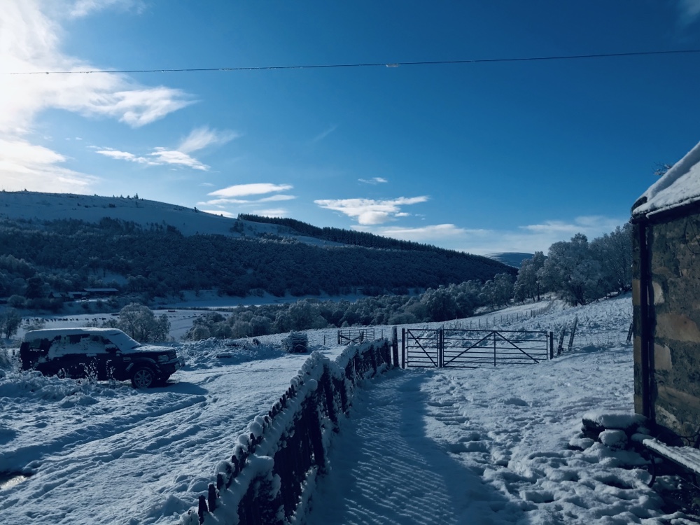
It’s great leaving our cottage and starting this trip off road. The Moray Way combines the Dava Way – Grantown on Spey to Forres with the Moray Coastal Trail – Findhorn to Spey Bay – and then the Speyside Way back home – about 110 miles, almost all off road.
There are stunning views which change with the seasons from our cottage, which I never tire of. Such as:
Winter a couple of years ago.
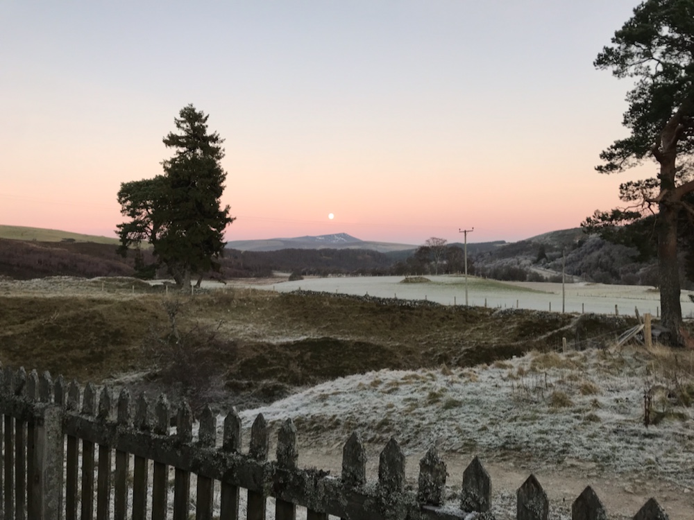
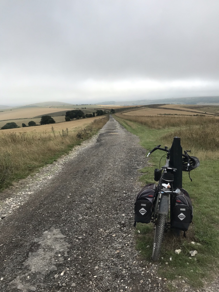
And here is the route I took:
The moon one winter’s afternoon.
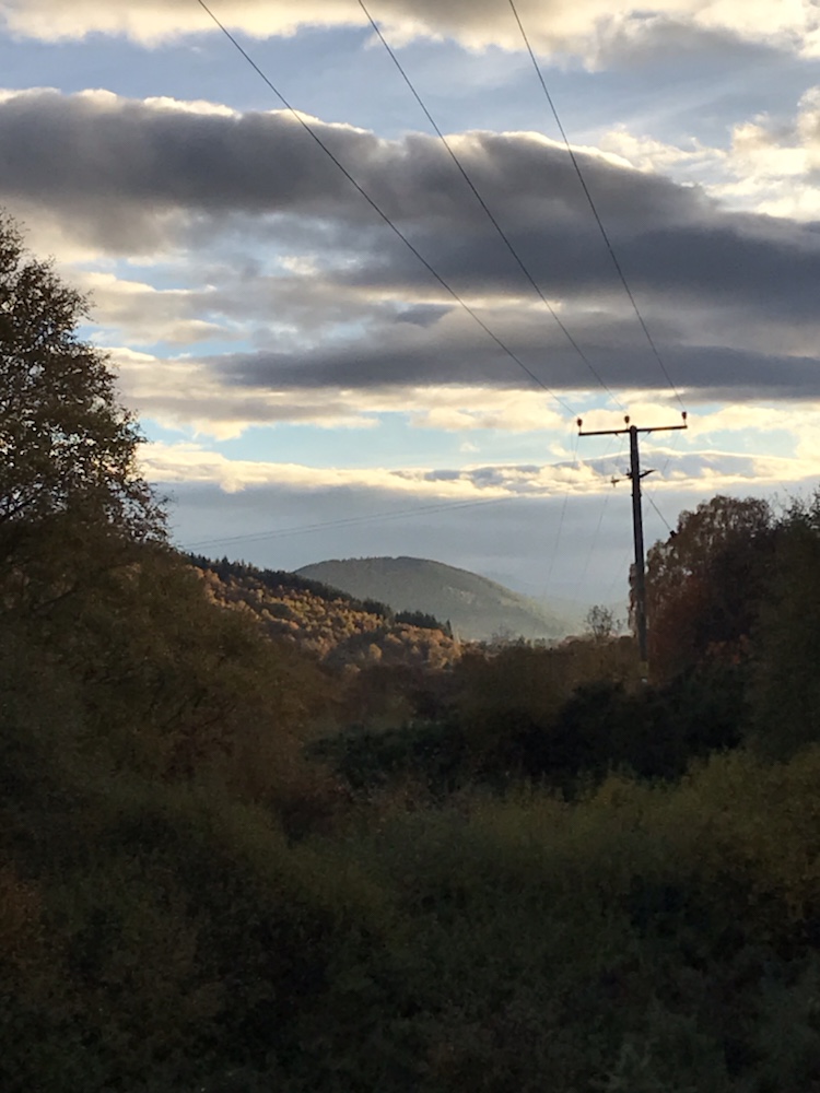
Recently:
Last Monday afternoon, on the track to Chapeltown.
After 6 or so miles I cycled across a railway bridge over the Spey:
Cragganmore
Then on to the B9102 to Grantown, a roller coaster tiny road that tracks the Spey:
Into Grantown after 20 miles and an excellent coffee at Base Camp Bikes. The Dava Way starts just outside. The Inverness and Perth Junction Railway, it’s snappy title, ran from Forres south for 100 miles to Dunkeld.
It took just 2 years to build, which seems incredibly fast, with the viaducts, bridges, cuttings , stations and so on. It opened in 1863.
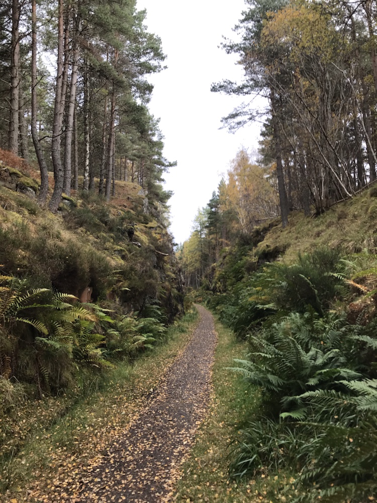
First I cycled through a rock cutting.
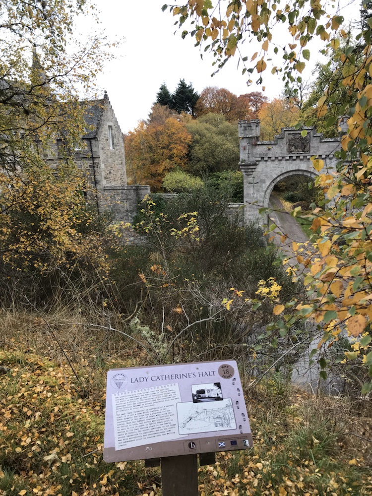
And then the embankment took me to:
As it says, Lady Catherine’s Halt.
But there was no Lady Catherine. This listed gatehouse was the price extracted for allowing the railway across the land of Lord whoever. But the trains did halt here for the great and good to disembark for one of those rambling Scottish baronial piles.
Talking of barons, at a viaduct there was a list of the directors – almost all land owning Scots nobility which no doubt ensured no objection from them.
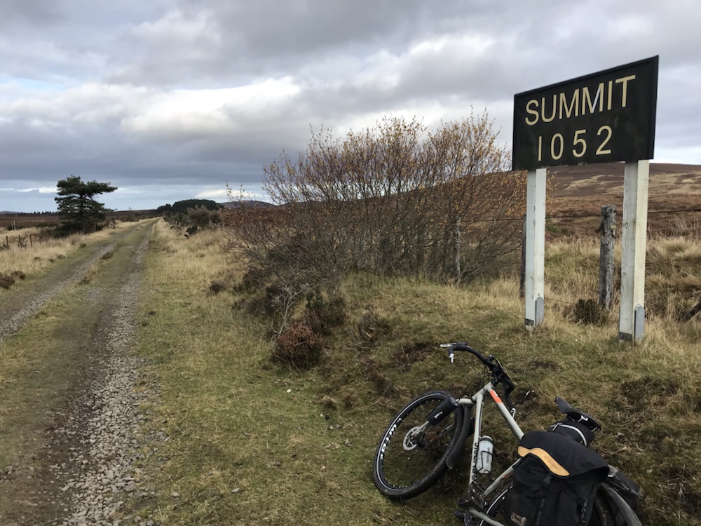
The surface of the track is mainly very good. It rises very gradually for some 6 or so miles. to:
The summit at 1052ft.
And then a gradual descent. I saw one other person – a walker – in the first 15 miles. This is a great route – easy, with lots to see (especially if you like Victorian engineering).
It is easy to imagine the steam trains coming down this track and difficult for some I’m sure not to make train noises.
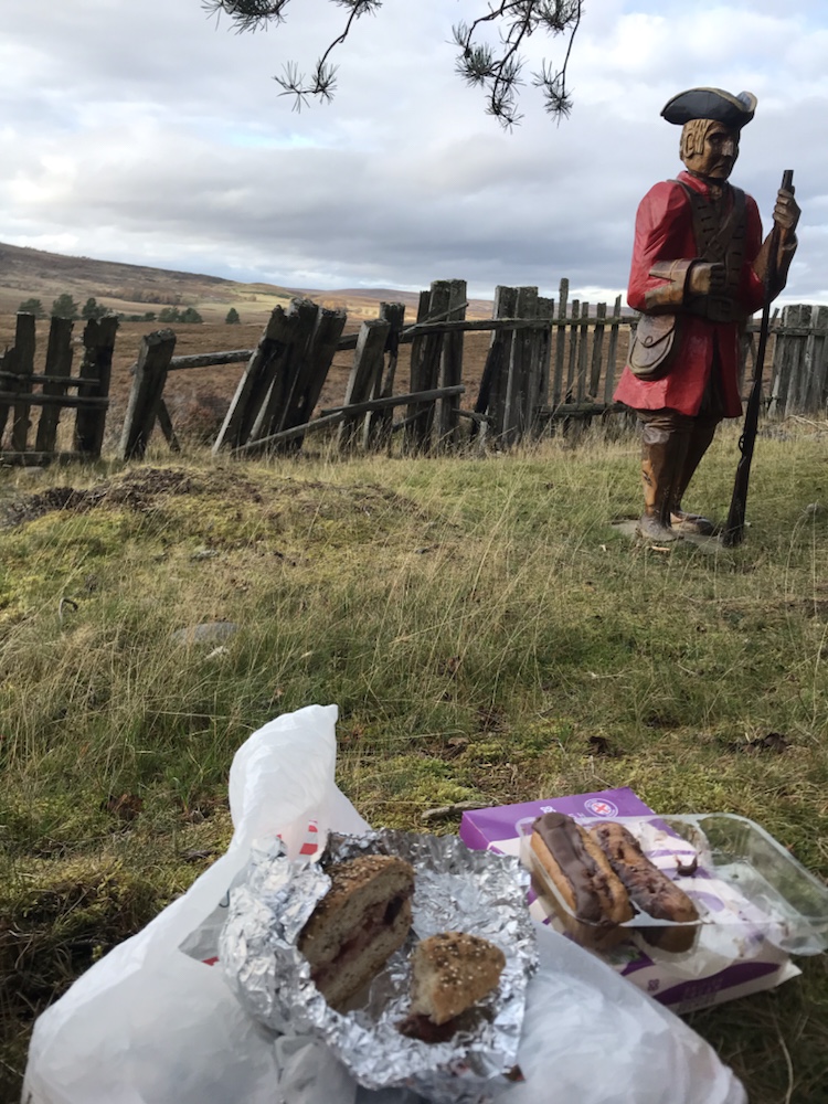
For lunch I had venison pâté rolls and chocolate eclairs:
Yes I ate the lot. All 4.
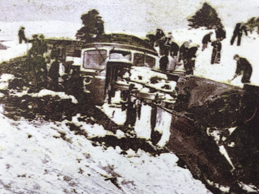
This moor gets a lot of snow; so much that in 1865 a train was marooned for a week up here. That led to the railway company building the world’s first snowplough that attached to a loco.
The snow was also bad in 1963 when the snowplough loco managed to run off the rails:
Stuck for days.
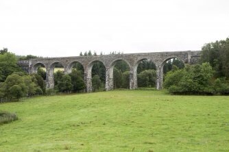
The railway cut the droving time for sheep from 4 weeks to 1 day! The Forres – Aviemore section closed in 1965. There are 8 viaducts; this is the one at Divie:
I couldn’t get down to get a pic so got this off the ‘net.
Here on the top of it:
There are also 126 bridges over rivers such as this one
Over the Bogeney Burn. The grass path is to allow the sheep to roam without crossing the line.
More track views:
There are also 119 road bridges:
“…the romantic Scurrypool bridge” as they said in 1863.
Apparently the railway owners wanted to combine function with good design; so this in its design is similar to Lady Catherine’s Halt.
Lots of sheep and cows:
And the sun came out briefly – great autumn colours:
The last of the rail track:
Approaching Forres
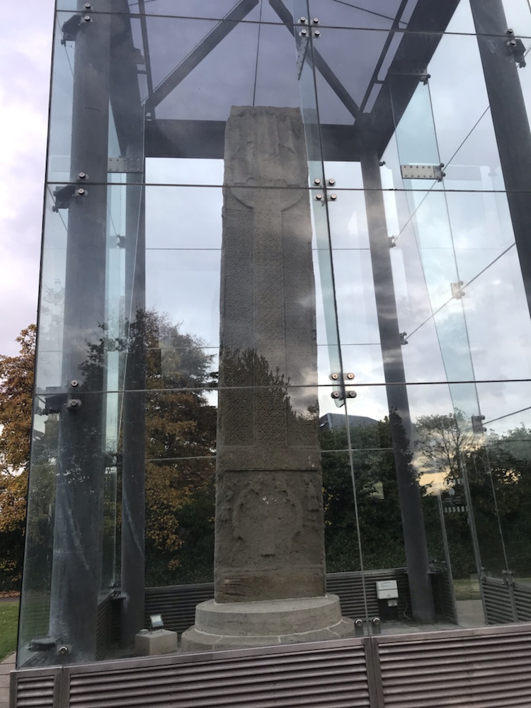
And then to Sueno’s Stone; the largest surviving Pictish stone in the UK:
Carved in about the 9th century.
Then a quick 5 mile cycle to Findhorn and it’s bay:
We were last here in September; there were dozens of moored boats. Now all ashore I guess for the winter.
On for a deserved pint at the Kimberley Arms:
Trade Winds. One of my favourite Scots ales.
Findhorn is very English; ages went by before I heard a Scottish accent. I went back to this pub for supper – the best fish stew I’ve had in ages.
A great first day. Weather doesn’t look too good for tomorrow but here’s hoping…
The third and final day of the SDW or as Roger who I cycled this over 30 years ago said “ if these are the South Downs I’d hate to be on the South Ups”.
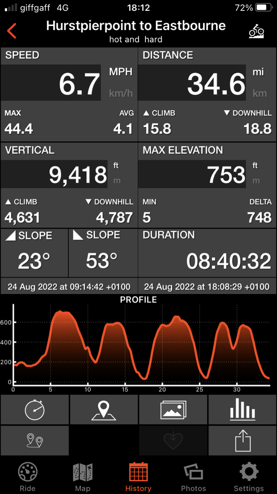
The final stats:
Sun almost all day! Average was actually less at 6.1mph. That it is mainly up or down and not much flat appears in the profile.
Hills walked up: too many to count.
Punctures: none I’m pleased to say. The flints did worry me.
I also did not fall off! It was slow and hot, with great views missing so far.
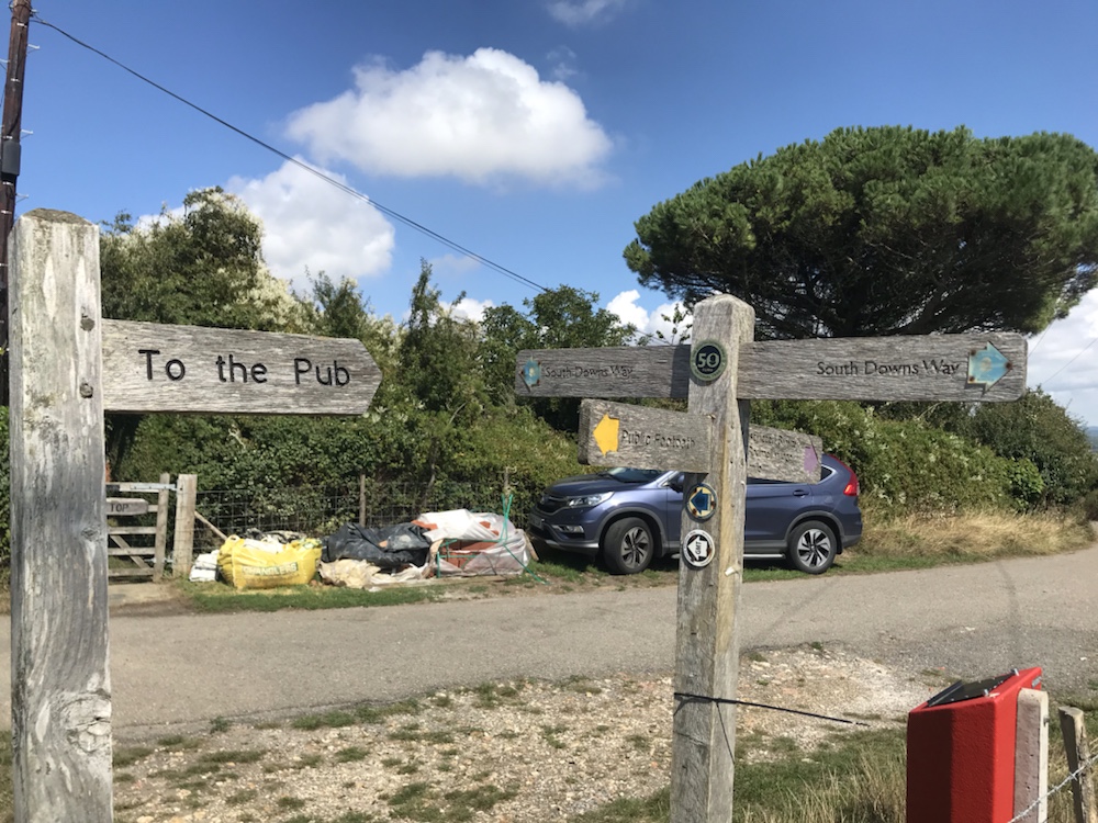
I passed a total of 112 signposts and went through 134 gates. Here is my favourite signpost(s):
Yes, it’s to the pub. Only one though but millions of the SDW ones.
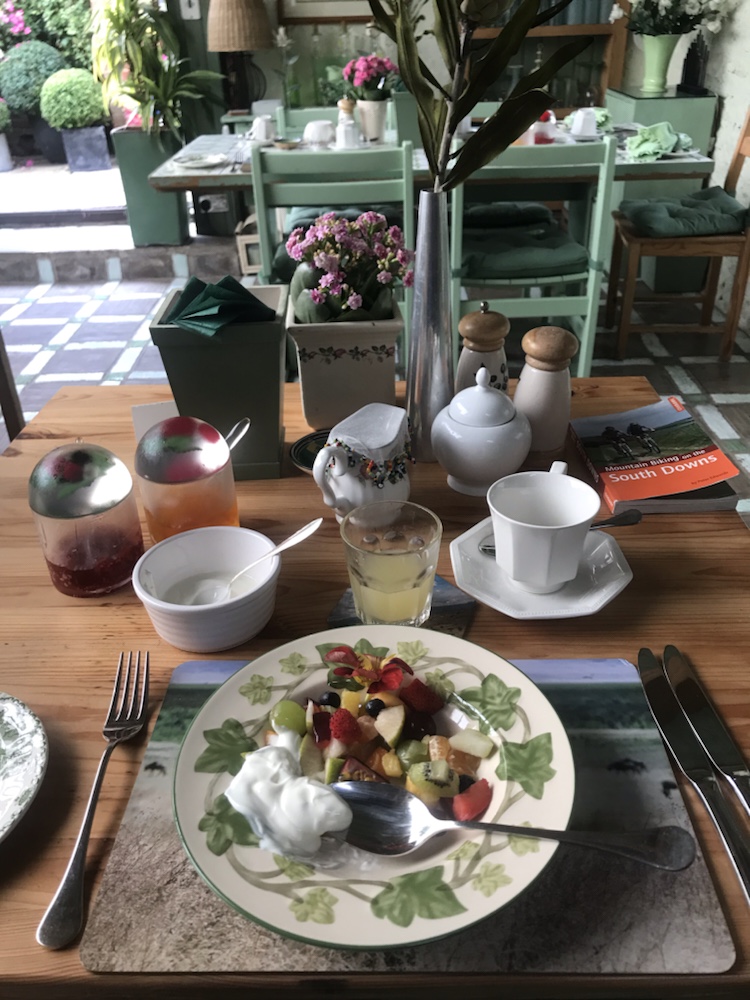
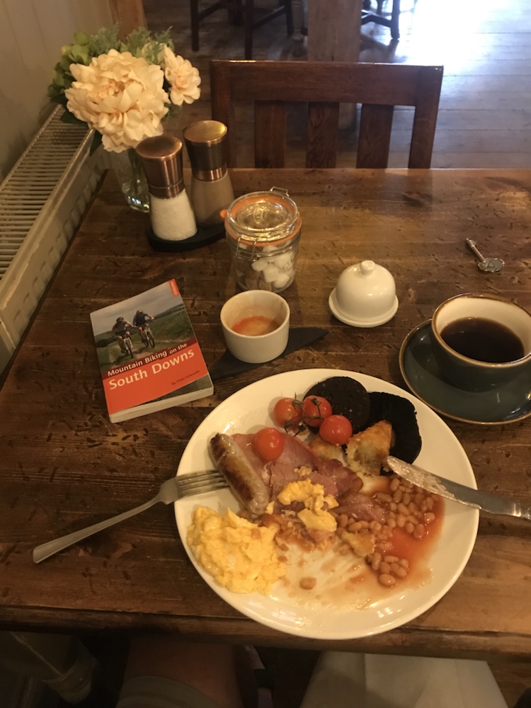
So what powered me up the downs?
Best fruit salad.
And…
Best presentation of full English. Overall winner of the SDW breakfast award 2022.
I set off via Hassocks to see my gran’s bungalow and the stream we played in as kids. Then the first climb; Ditchling Beacon. I’m glad to say I cycled up it, with a lot of huffing, puffing and some swearing.
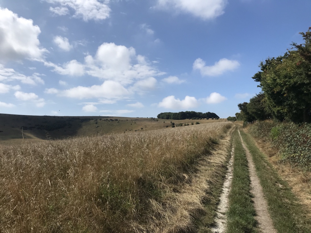
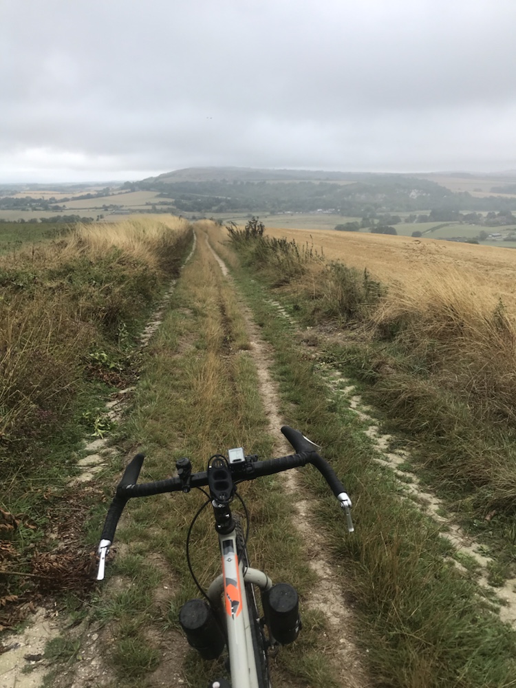
On the downs and the sun came out and stayed out. Great views and more typical down land open scenery.
A lot faster on the tracks especially as many were in grass which oddly was still green and not burnt as elsewhere :
The lack of flints made up and down far more pleasant.
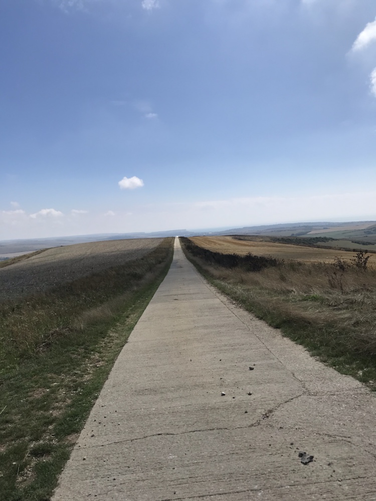
Then an odd concrete track through fields:
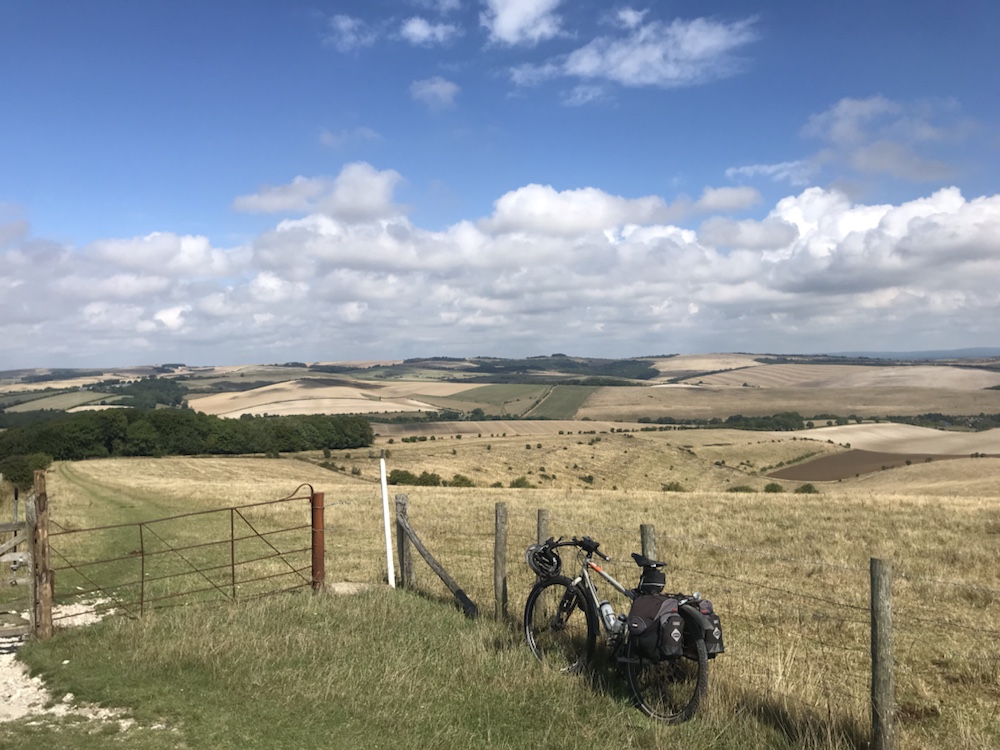
And the sea in the distance!
The last two hills were tough; steep and poor surfaces . I saw far more walkers and cyclists, almost half of the latter on electric MTBs. Must admit I did envy them!
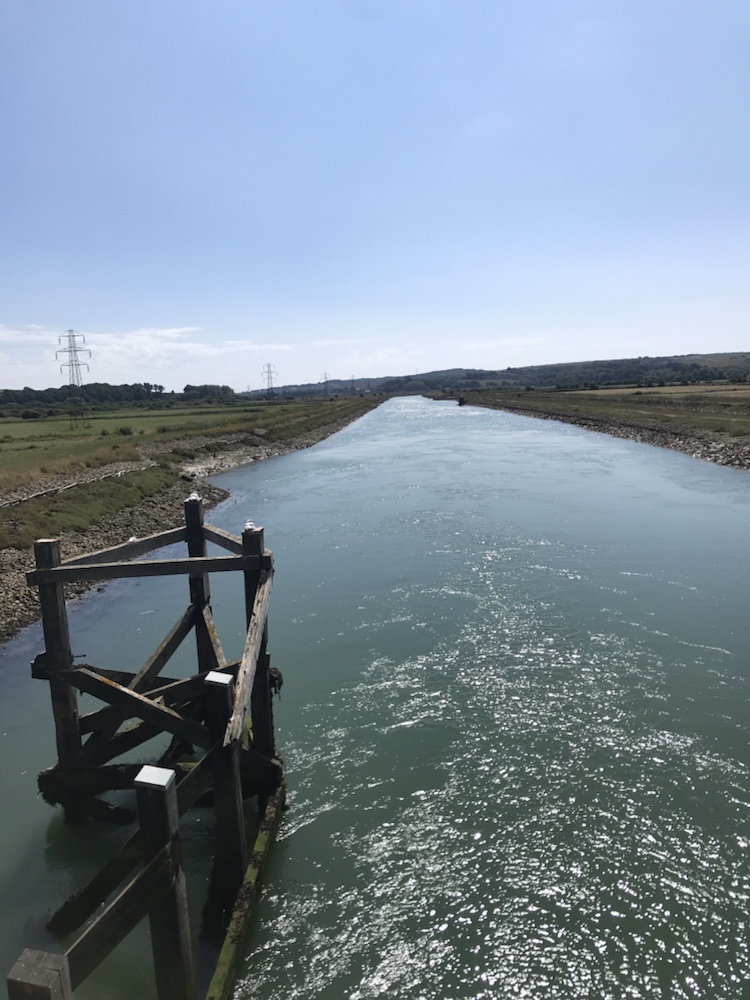
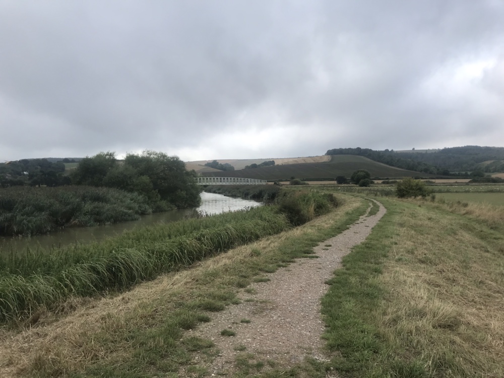
Then the River Ouse rushing down to Newhaven:
Yes, a flat bit. Which means climbing up again…
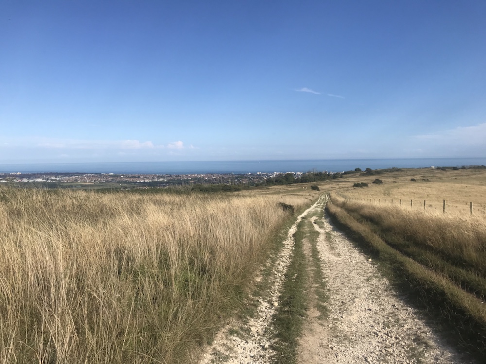
Then, after a slog up a chalk track the end in sight:
Eastbourne, in its full err… glory
I found a good track down to the town and just caught the London train.
One of the hardest days cycling I’ve done in years; my lack of fitness met my lack of mountain biking experience.
The stats : 45.2 miles (on SDW 34, remainder on tarmac), at an average 6.8mph (just 5.9 on SDW).
Max height just 799ft but 6,972ft of ascent and 7,054 of descent.
Pushing up hills: tons. Even walked down a few difficult descents.
Fell off : twice.
Weather: it only rained once. For 5.5 hours.(I’m not exaggerating ).
This was the slowest off road I’ve done – I was faster each day when I did the Cairngorms Loop. To my great surprise todays route is harder than anything I’ve done in Scotland.
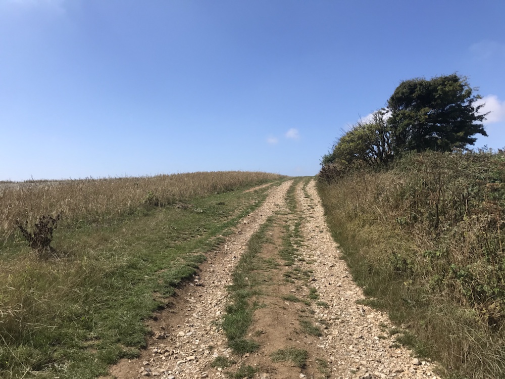
That is down to the constant short sharp hills combined with the rough nature of the tracks, especially the gravel and the chalk, the former shaking me and the bike to bits and the latter being very slippery when wet.
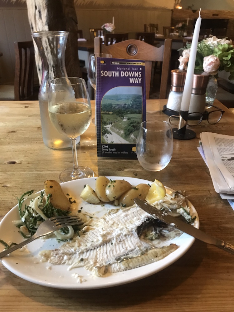
But I had a great meal last night in the White Hart:
Plaice. Or what remains of it.
And breakfast did not disappoint:
I had the healthy option; eggs scrambled not fried.
Forecast was grey but dry. At least they got the grey bit right. I bought lunch and a ‘paper in the village shop and set off about 9.15. A humid ascent back up to the SDW in still air.
All went fine but then the rain came in and stayed in. It took me 2 hours to cycle the first 9 miles as I did 2,000 ft of up and 1,500 ft of down – I’ve never made such slow progress.
The Downs were shrouded in mist and only occasionally it lifted, so no views for ages.
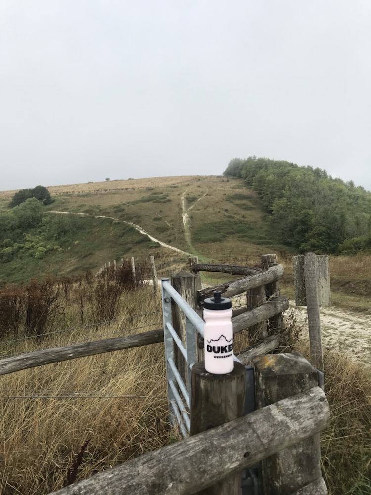
I saw this water bottle- I reckon the owner ditched it to lessen their load up the hill you see – like many it was too difficult to cycle up and tricky to cycle down.
Progress was very slow, not helped by sliding around in the chalk. But the miles ticked by and gradually it cleared.
Another rattling descent.
Then after about 20 miles I hit the flat:
This should have a sign: “Only flat bit for 20 miles “
I saw many more cyclists and walkers today, unsurprisingly as this is far better for both users.
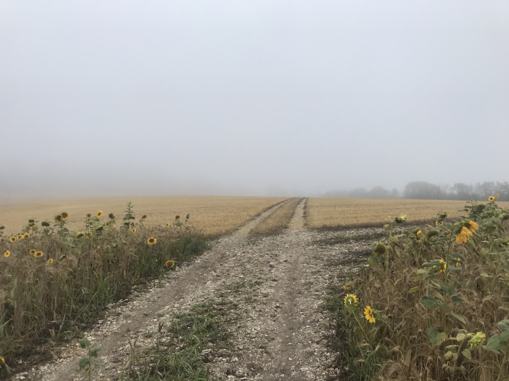
Bedraggled sunflowers looking for the sun. None of us saw it today.The last long descent.
As progress was slow and I was knackered I decide against more pushing up slopes like this:
Typical downland view.
I had about 7 miles left in the SDW but decided to cycle to the B&B on tarmac – about 11 miles. So much easier!
Clayton Wickham Farmhouse is really special – it dates back to the Middle Ages. The owners, Mike and Susie are very welcoming. Quick shower and off for a couple of pints of my favourite bitter; the locally brewed Harvey’s Best.
The farmhouse is quite remote and as I type this drivel I can hear an owl close by. And so to sleep, looking forward to an easier and faster day tomorrow, possibly even some sun.